")
")
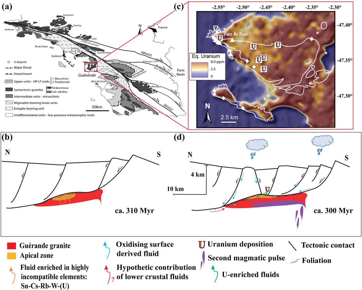
Fig. 13
Download original image
Conceptual model showing the main phases of the evolution of uranium mineralization in the Guérande system. (a): Guérande localization in the South Armoricain Domain. (b): Airborne radiometric map showing the distribution of uranium in the Guérande area. (c) Syn-detachment emplacement of the granitic pluton at ca. 310 Myr where the apical zone is enriched in incompatible elements; (d) Exhumation and subsequent brittle deformation at ca. 300 Myr allowing the infiltration of oxidizing meteoric fluids able to leach uranium from the granite and transport uraniferous species along faults. A renewed magmatic activity is recorded at 300 Myr through the leucogranitic dyke emplacement. Precipitation of uraninite occurred along faults crosscutting black shales in the detachment upper plate. Modified after Ballouard et al. (2017)
Current usage metrics show cumulative count of Article Views (full-text article views including HTML views, PDF and ePub downloads, according to the available data) and Abstracts Views on Vision4Press platform.
Data correspond to usage on the plateform after 2015. The current usage metrics is available 48-96 hours after online publication and is updated daily on week days.
Initial download of the metrics may take a while.