")
")
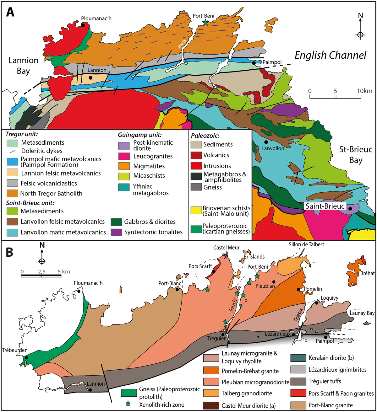
Fig. 2
Download original image
(A) Sketch map identifying the Trégor, Saint-Brieuc and Guinguamp Cadomian tectonometamorphic units to the west of the Saint-Brieuc Bay (modified from Plaine, 2011, unpublished, and from the geological map of France 1/50 000 “vecteur harmonisée”, BRGM, available at http://infoterre.brgm.fr; see also: Chantraine et al., 2001; Ballèvre et al., 2001); note that some of the volcanic and sedimentary rocks from the southern Trégor unit (e.g., Paimpol Formation) may alternatively be associated with the Saint-Brieuc unit (see text; Chantraine et al., 2001); (B) Simplified geological map of the North Trégor volcano-plutonic complex (from Auvray, 1979; Graviou, 1984); dykes are not shown.
Current usage metrics show cumulative count of Article Views (full-text article views including HTML views, PDF and ePub downloads, according to the available data) and Abstracts Views on Vision4Press platform.
Data correspond to usage on the plateform after 2015. The current usage metrics is available 48-96 hours after online publication and is updated daily on week days.
Initial download of the metrics may take a while.