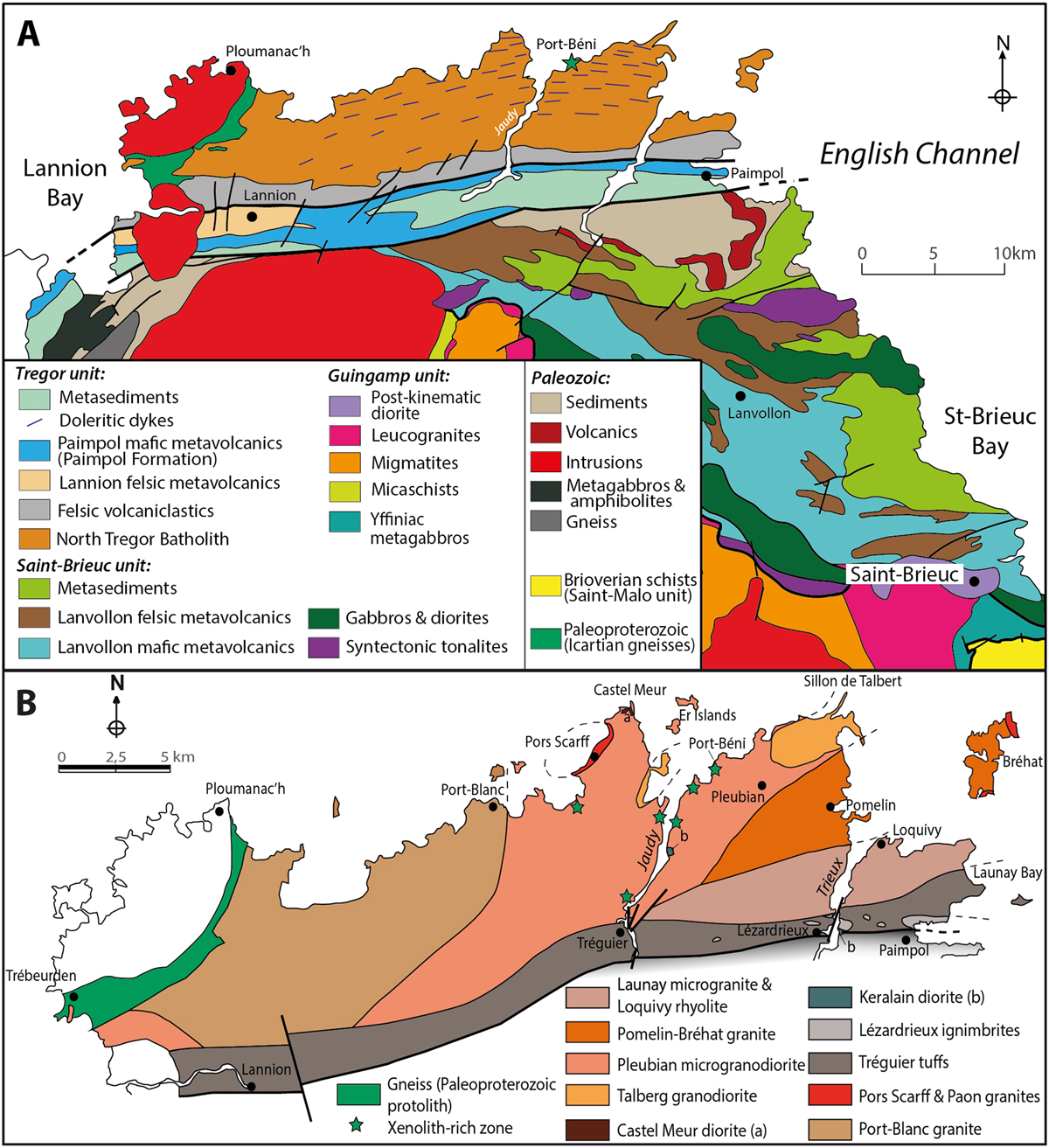
Fig. 2

Download original image
(A) Sketch map identifying the Trégor, Saint-Brieuc and Guinguamp Cadomian tectonometamorphic units to the west of the Saint-Brieuc Bay (modified from Plaine, 2011, unpublished, and from the geological map of France 1/50 000 “vecteur harmonisée”, BRGM, available at http://infoterre.brgm.fr; see also: Chantraine et al., 2001; Ballèvre et al., 2001); note that some of the volcanic and sedimentary rocks from the southern Trégor unit (e.g., Paimpol Formation) may alternatively be associated with the Saint-Brieuc unit (see text; Chantraine et al., 2001); (B) Simplified geological map of the North Trégor volcano-plutonic complex (from Auvray, 1979; Graviou, 1984); dykes are not shown.
Les statistiques affichées correspondent au cumul d'une part des vues des résumés de l'article et d'autre part des vues et téléchargements de l'article plein-texte (PDF, Full-HTML, ePub... selon les formats disponibles) sur la platefome Vision4Press.
Les statistiques sont disponibles avec un délai de 48 à 96 heures et sont mises à jour quotidiennement en semaine.
Le chargement des statistiques peut être long.


