")
")
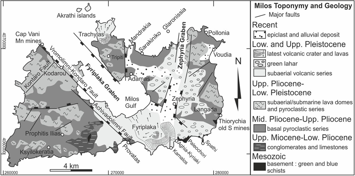
Fig. 3
Download original image
Toponymy and synthetic geological map of Milos Island, based on the bibliography cited in the text and this study. The main tectonic structures (e.g., the Zephyria and Fyriplaka grabens), Quaternary volcanic centres (e.g., Trachylas, Fyriplaka), and mines (e.g., Cape Vani, Thiorychia) are also indicated.
Toponymie et carte géologique synthétique de l’île de Milos réalisée à partir de la bibliographie citée dans le texte et cette étude. Les principales structures tectoniques (e.g., le graben de Zephyria, le graben de Fyriplaka), les centres volcaniques du Quaternaire (e.g., Trachylas, Fyriplaka) et les mines (e.g., Cap Vani, Thiorychia) sont également indiqués.
Current usage metrics show cumulative count of Article Views (full-text article views including HTML views, PDF and ePub downloads, according to the available data) and Abstracts Views on Vision4Press platform.
Data correspond to usage on the plateform after 2015. The current usage metrics is available 48-96 hours after online publication and is updated daily on week days.
Initial download of the metrics may take a while.