")
")
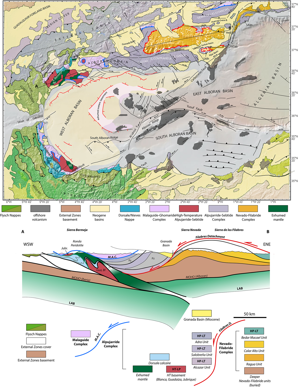
Fig. 2
Download original image
Tectonic map of the Alboran Sea, the Betic Cordilleras and the Rif, compiled from Comas et al. (1999), d’Acremont et al. (2020) and Chalouan et al. (2008). Lithospheric-scale E-W section through the Betic Cordillera. Deep crustal and lithospheric structures after de Lis Mancilla et al. (2018) and Gueydan et al. (2019). The Ronda peridotite massif is sandwiched between the Guadaiza and Blanca units underneath and the Jubrique Unit above. Abbreviations: Bl: Blanca, BB: Beni Bousera, Gua: Guadaiza, Jubr: Jubrique, LAB: lithosphere-Asthenosphere boundary, M.A.C.: Malaguide-Alpujárride Contact detachment, Pz: Paleozoic, RP: Ronda Peridotite.
Current usage metrics show cumulative count of Article Views (full-text article views including HTML views, PDF and ePub downloads, according to the available data) and Abstracts Views on Vision4Press platform.
Data correspond to usage on the plateform after 2015. The current usage metrics is available 48-96 hours after online publication and is updated daily on week days.
Initial download of the metrics may take a while.