")
")
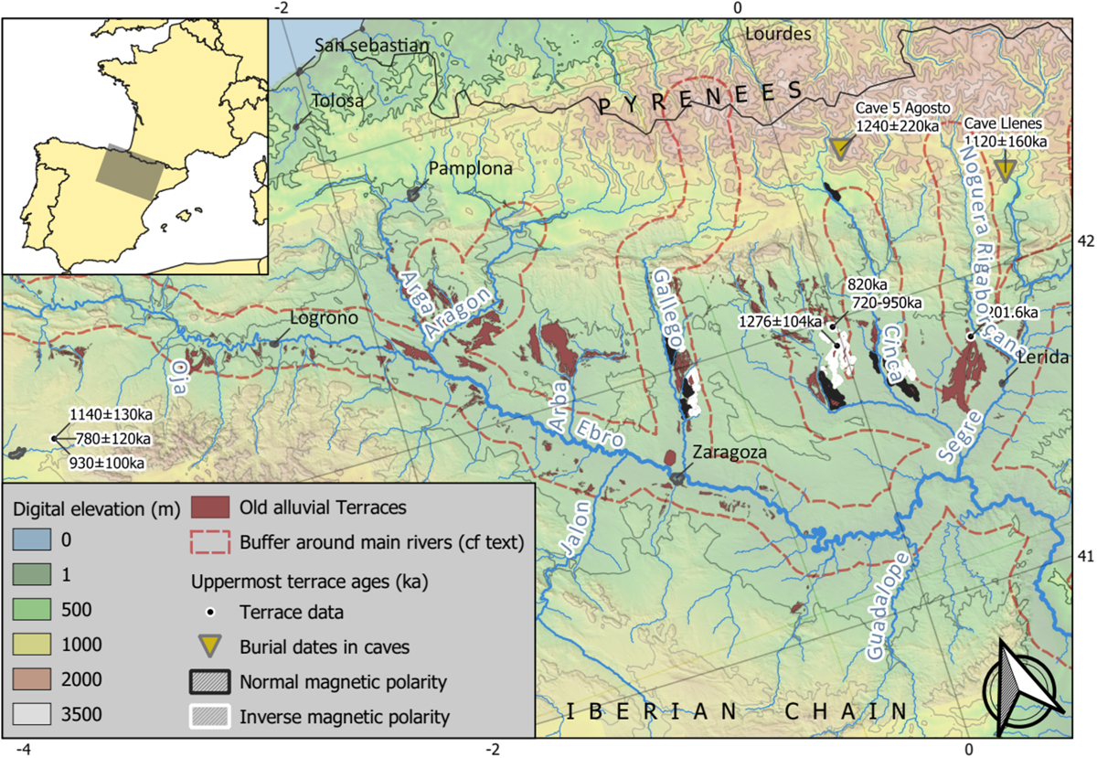
Fig. 1
Download original image
Topographic map of Ebro Basin showing the position of topmost terraces together with their ages and paleomagnetic polarity data (Benito et al., 1998; Moreno et al., 2012; Calle et al., 2013; Stange et al., 2013a; Duval et al., 2015; Lewis et al., 2017). Two burial ages in caves from Genti (2015) which are likely related to these topmost terraces are also indicated. The 10-km wide buffer around the rivers serve for the drawing of Figure 6. An enlarged version of this figure can be found on Zenodo (https//doi.org/10.5281/zenodo.4721256).
Current usage metrics show cumulative count of Article Views (full-text article views including HTML views, PDF and ePub downloads, according to the available data) and Abstracts Views on Vision4Press platform.
Data correspond to usage on the plateform after 2015. The current usage metrics is available 48-96 hours after online publication and is updated daily on week days.
Initial download of the metrics may take a while.