")
")
Fig. 1
Download original image
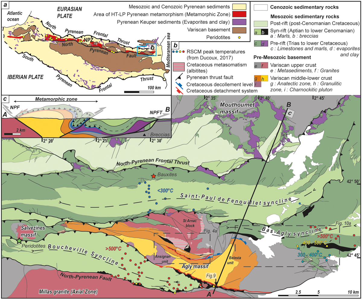
Geological map of the Agly Massif and north-eastern Pyrenees. a) Simplified geological map of the Pyrenean belt. b) Geological map of the Eastern NPZ after Fonteilles et al. (1993), Delay (1989) and our own field mapping. c) SSW-NNE cross-section of the Agly region (see location on the geological map), no vertical exaggeration.
Cartes géologiques du Massif de l’Agly et de la Zone Nord-Pyrénéenne. a) Carte simplifiée de la chaîne des Pyrénées. b) Carte géologique de la Zone Nord-Pyrénéenne orientale d’après Fonteilles et al. (1993), Delay (1989) et notre propre travail cartographique. c) Coupe orientée SSW-NNE suivant le tracé localisé sur la carte b.
Current usage metrics show cumulative count of Article Views (full-text article views including HTML views, PDF and ePub downloads, according to the available data) and Abstracts Views on Vision4Press platform.
Data correspond to usage on the plateform after 2015. The current usage metrics is available 48-96 hours after online publication and is updated daily on week days.
Initial download of the metrics may take a while.