")
")
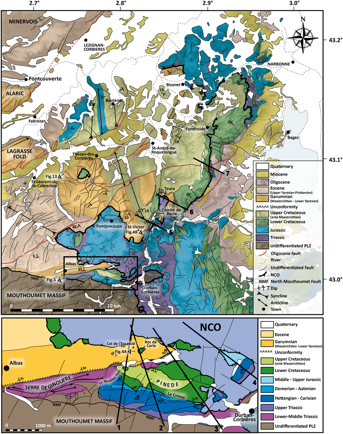
Fig. 3
Download original image
Structural map of the NCO modified after Lézignan-Corbières, Béziers, Capendu, Narbonne, Tuchan and Leucate 1/50 000 BRGM geological maps (Ellenberger et al., 1987; Lespinasse, 1982; Berger, 1982; Berger et al., 1982, 1990, 1997) and focus on the geological map of the “Serre de Ginoufre” and the “Pinède de Durban” modified from Durand-Delga and Charrière (2012). Mapped cross-sections correspond to the geological sections in Figure 7.
Current usage metrics show cumulative count of Article Views (full-text article views including HTML views, PDF and ePub downloads, according to the available data) and Abstracts Views on Vision4Press platform.
Data correspond to usage on the plateform after 2015. The current usage metrics is available 48-96 hours after online publication and is updated daily on week days.
Initial download of the metrics may take a while.