")
")
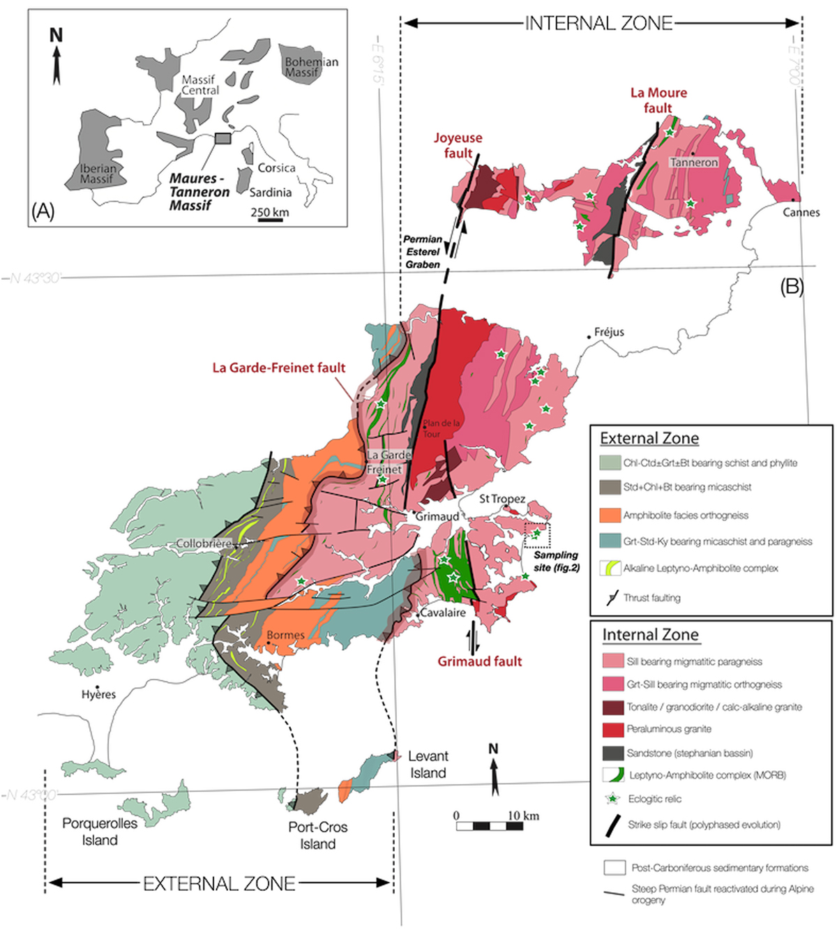
Fig. 1
Download original image
(A) Location of the Maures-Tanneron in southeast France. European Variscan massifs are indicated in grey. (B) Geological map of the Maures-Tanneron Massif showing the External and Internal Zones (modified after Seyler, 1986, Bellot, 2005, Schneider et al., 2014 and Gerbault et al., 2018). Green stars represent the main occurrences of eclogites. The sampling site of interest is indicated.
(A) Localisation du massif des Maures-Tanneron dans le Sud-Est de la France. Les massifs de la chaîne Varisque d’Europe apparaissent en gris. (B) Carte géologique du Massif des Maures-Tanneron présentant les zones externes et internes (modifiée d’après Seyler, 1986, Bellot, 2005, Schneider et al., 2014 et Gerbault et al., 2018). Les principaux affleurements d’éclogites sont mentionnés par les étoiles vertes. Le site d’échantillonnage des éclogites étudiées est encadré sur la carte.
Current usage metrics show cumulative count of Article Views (full-text article views including HTML views, PDF and ePub downloads, according to the available data) and Abstracts Views on Vision4Press platform.
Data correspond to usage on the plateform after 2015. The current usage metrics is available 48-96 hours after online publication and is updated daily on week days.
Initial download of the metrics may take a while.