")
")
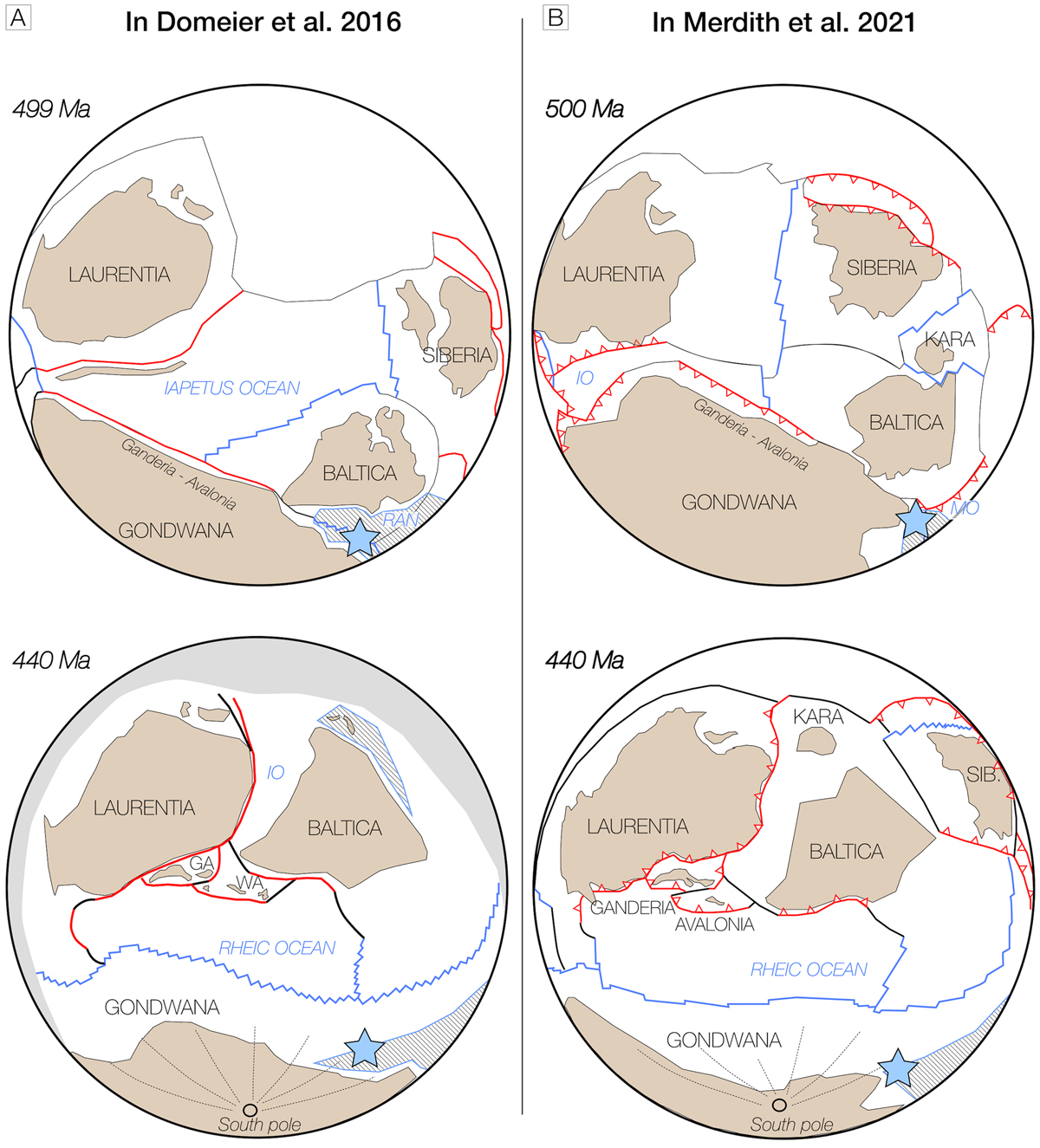
Fig. 14
Download original image
Probable location of the MTM eclogite oceanic protoliths during early Cambrian and early Silurian, in the framework of available paleomagnetic unified full plates reconstruction models: (A) after Domeier (2016) and (B) after Merdith et al. (2021). IO: Iapetus Ocean; MO: Mirovoi Ocean; GA: Ganderia; WA: West Avalonia. The blue star figures a possible location of the MTM (MECS micro-plate) in northeastern Gondwana active margin, after Avigad et al. (2012) and Tabaud et al. (2022). In the model of Domeier (2016), the dashed external boundary is an arbitrary perimeter marking the outer limit of the domain considered. The grey hatched areas represent the preserved pieces of early Cambrian oceanic crust, within the region of interest, during early Silurian oceans development.
Localisation probable des protolithes océaniques des éclogites du MTM, au Cambrien inférieur et au Silurien inférieur sur la base des modèles paléomagnétiques globaux unifiés: (A) d’après Domeier (2016) et (B) d’après Merdith et al. (2021). IO : Ocean Iapetus ; MO : Ocean Mirovoi ; GA : Ganderia ; WA : West Avalonia. L’étoile bleue correspond à une localisation du MTM (microplaque MECS) au Nord-Est de la marge active du Gondwana, d’après Avigad et al. (2012) et Tabaud et al. (2022). Dans les représentations de Domeier (2016), la zone grisée correspond à une limite arbitraire de résolution du modèle. En gris hachuré sont représentées les portions de croûte océanique d’âge Cambrien inférieur préservées, dans la région d’intérêt, lors des océanisations du Silurien inférieur.
Current usage metrics show cumulative count of Article Views (full-text article views including HTML views, PDF and ePub downloads, according to the available data) and Abstracts Views on Vision4Press platform.
Data correspond to usage on the plateform after 2015. The current usage metrics is available 48-96 hours after online publication and is updated daily on week days.
Initial download of the metrics may take a while.