")
")
Fig. 2
Download original image
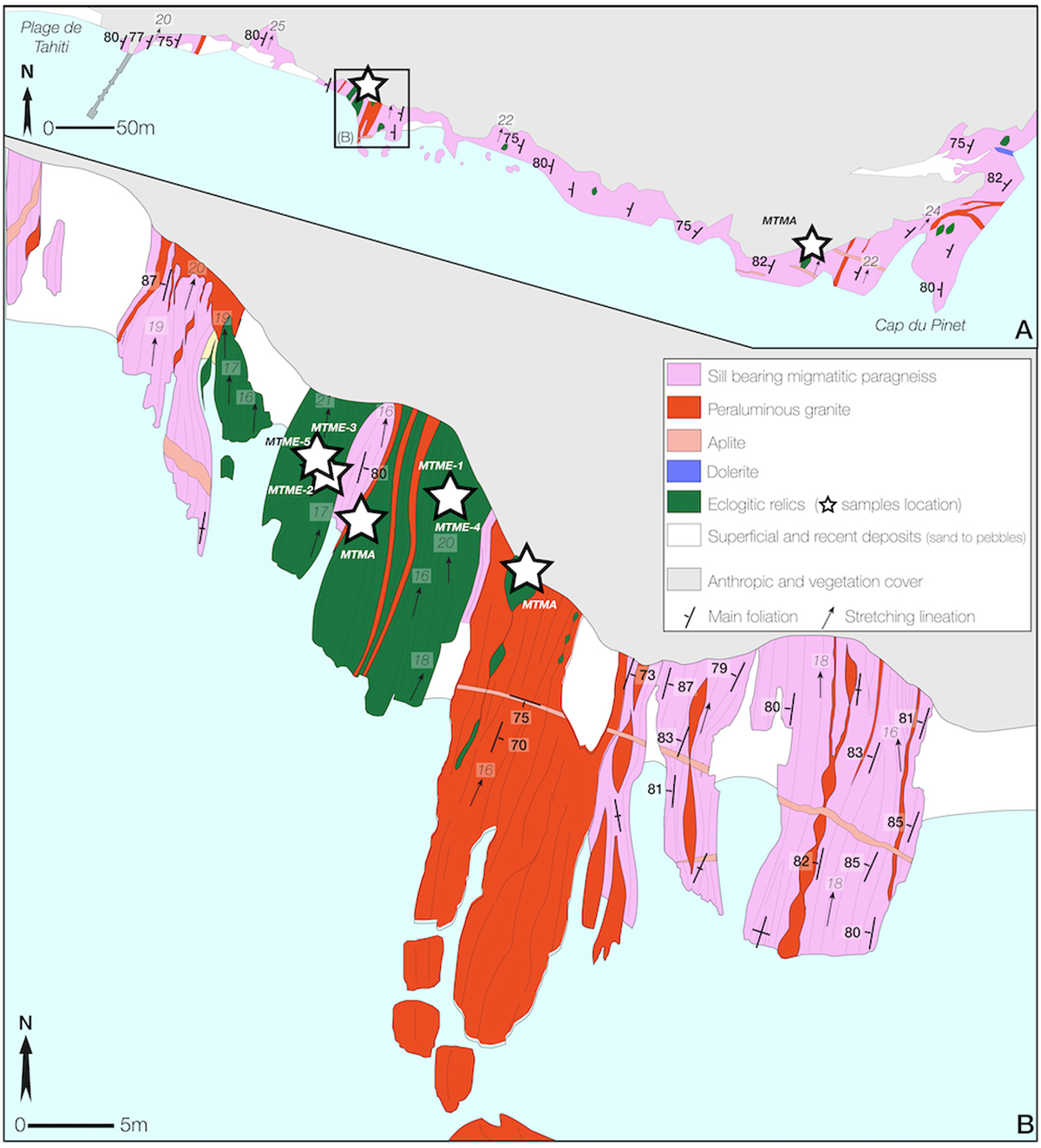
(A) Geological sketch map of the coastline between Tahiti Beach and Cap du Pinet (see location in Fig. 1). (B) Detailed lithological and structural map of the main and most significant outcrop. White stars represent sample locations.
(A) Carte géologique de la ligne de côte entre la plage de Tahiti et le Cap du Pinet (localisée sur la Fig. 1). (B) Carte lithologique et structurale de l’affleurement principal sélectionné pour cette étude. Les étoiles blanches indiquent les sites de prélèvement.
Current usage metrics show cumulative count of Article Views (full-text article views including HTML views, PDF and ePub downloads, according to the available data) and Abstracts Views on Vision4Press platform.
Data correspond to usage on the plateform after 2015. The current usage metrics is available 48-96 hours after online publication and is updated daily on week days.
Initial download of the metrics may take a while.