")
")
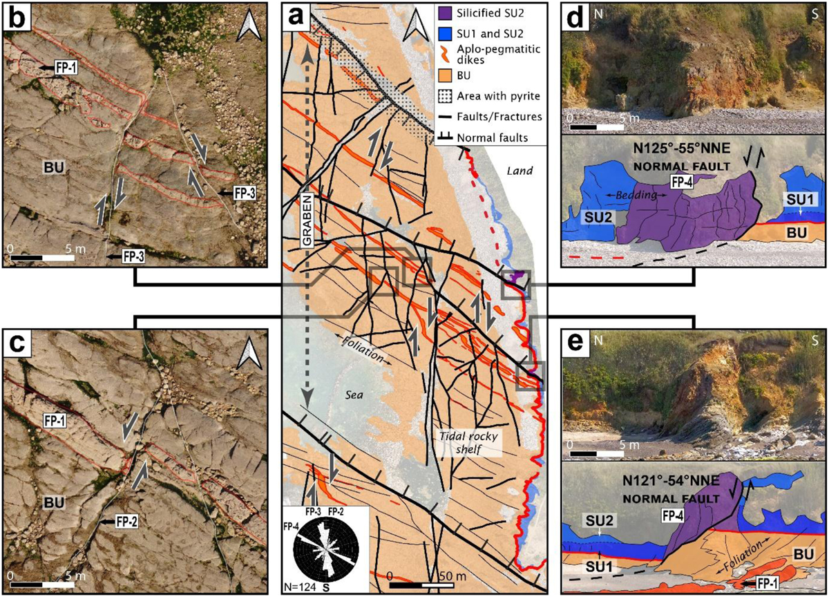
Fig. 5
Download original image
Cayola Bay outcrop. (a) Interpreted UAV orthoimage of the S.E. side of the NW-SE oriented Cayola bay graben with fault motions reported and weighted rose diagram. (b) Orthoimage extract showing dextral ductile-brittle deformation of the aplo-pegmatitic dike (underlined in red) by NNW-SSE to N-S faults on the rocky shelf. (c) UAV Orthoimage extracts showing a sinistral deformation of the dike by NNE-SSW faults. (d) and (e) coastal cliff picture and interpretation of the normal faults shifting the unconformity and associated silicification of the cover. See Table 1 for brittle structure nomenclature.
Current usage metrics show cumulative count of Article Views (full-text article views including HTML views, PDF and ePub downloads, according to the available data) and Abstracts Views on Vision4Press platform.
Data correspond to usage on the plateform after 2015. The current usage metrics is available 48-96 hours after online publication and is updated daily on week days.
Initial download of the metrics may take a while.