Fig. 5

Download original image
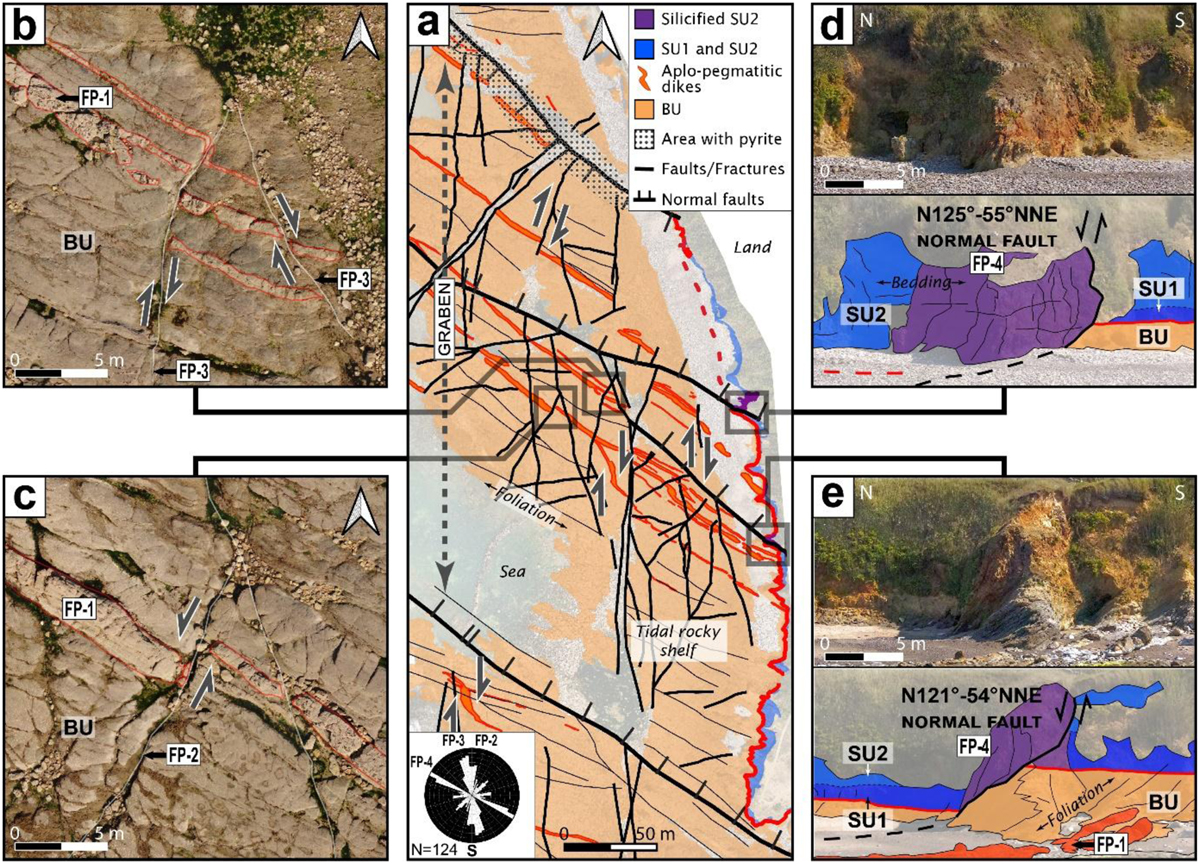
Cayola Bay outcrop. (a) Interpreted UAV orthoimage of the S.E. side of the NW-SE oriented Cayola bay graben with fault motions reported and weighted rose diagram. (b) Orthoimage extract showing dextral ductile-brittle deformation of the aplo-pegmatitic dike (underlined in red) by NNW-SSE to N-S faults on the rocky shelf. (c) UAV Orthoimage extracts showing a sinistral deformation of the dike by NNE-SSW faults. (d) and (e) coastal cliff picture and interpretation of the normal faults shifting the unconformity and associated silicification of the cover. See Table 1 for brittle structure nomenclature.
Les statistiques affichées correspondent au cumul d'une part des vues des résumés de l'article et d'autre part des vues et téléchargements de l'article plein-texte (PDF, Full-HTML, ePub... selon les formats disponibles) sur la platefome Vision4Press.
Les statistiques sont disponibles avec un délai de 48 à 96 heures et sont mises à jour quotidiennement en semaine.
Le chargement des statistiques peut être long.


