")
")
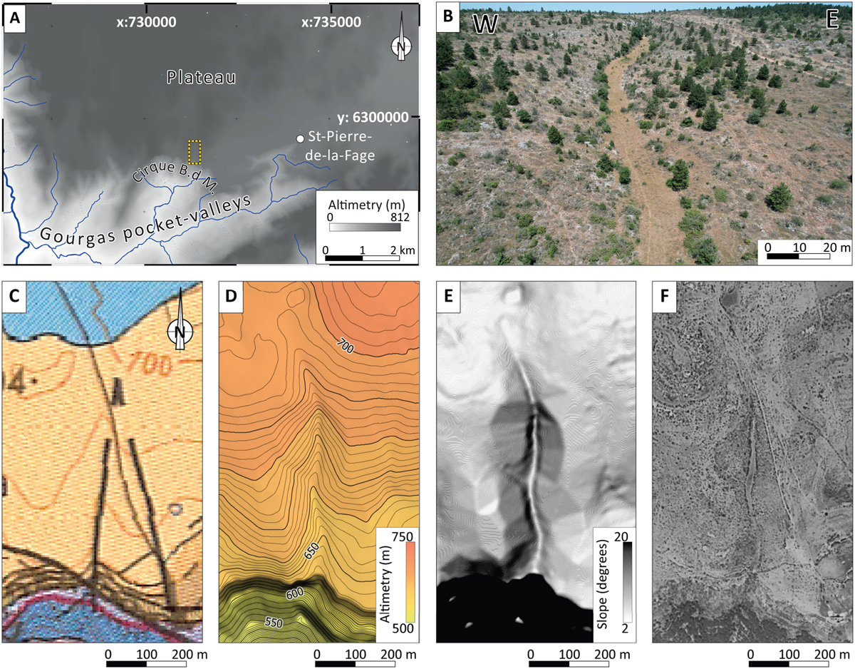
Fig. 6
Download original image
A. Digital Elevation Model (DEM) of the study area (location shown in Figure 5) with a 1-m pixel resolution, sourced from the IGN online facility. B to F. Various views of the same alteration corridor identified on the field, which were used to establish a set of morphological criteria (location shown in A). B. Drone oblique view of a linear dry valley not associated with an upstream watershed on the surface. C. On the geological map (Alabouvette et al., 1988), this same feature is interpreted as a fault, although it does not offset beddings. D. On the DEM, it can be described as a linear furrow, and where it intersects with the scarp, it forms a concave notch. E. The slope model highlights the contrast between the steep scarp and the flat bottom of the dry valley. F. In historical aerial photographs, it appears as a grassy meadow, while the steep edges display visible bedrock and bushes.
Current usage metrics show cumulative count of Article Views (full-text article views including HTML views, PDF and ePub downloads, according to the available data) and Abstracts Views on Vision4Press platform.
Data correspond to usage on the plateform after 2015. The current usage metrics is available 48-96 hours after online publication and is updated daily on week days.
Initial download of the metrics may take a while.