")
")
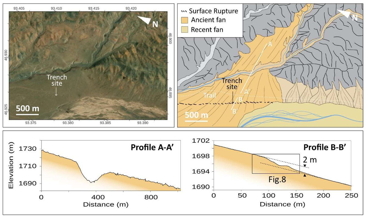
Fig. 7
Download original image
Satellite view, sketch map of Changing wind trench site and topographic profile analysis. Profile A-A’ highlights the slope of the ancient fan. Profile B-B’ show local topography (mole track and pond) associated to the fault and vertical component of the deformation is underlined by slope projection (dashed lines) of hanging wall and footwall of the fault.
Current usage metrics show cumulative count of Article Views (full-text article views including HTML views, PDF and ePub downloads, according to the available data) and Abstracts Views on Vision4Press platform.
Data correspond to usage on the plateform after 2015. The current usage metrics is available 48-96 hours after online publication and is updated daily on week days.
Initial download of the metrics may take a while.