")
")
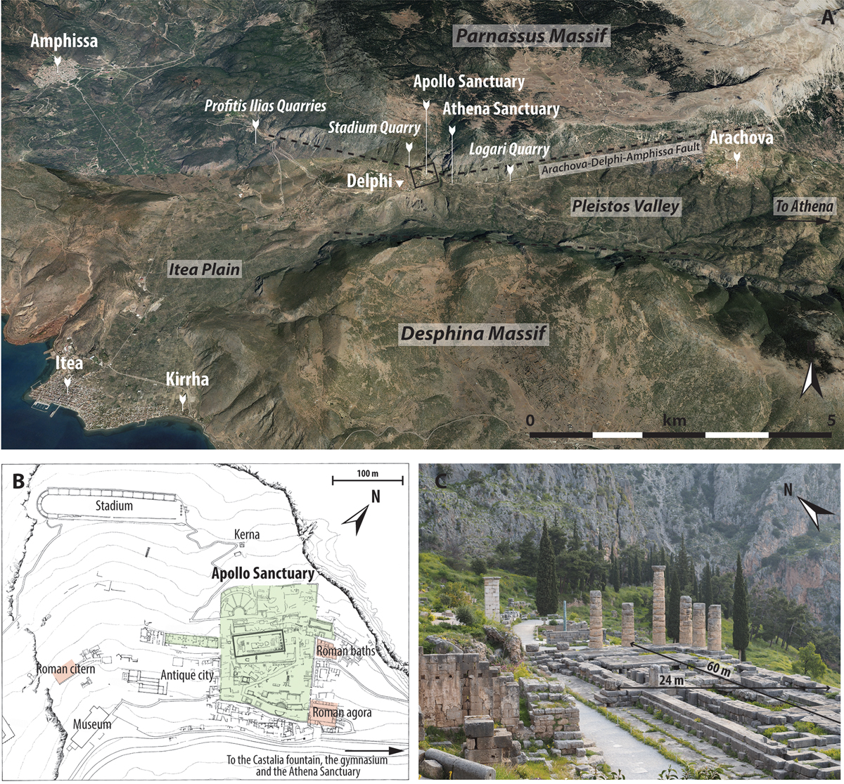
Fig. 3
Download original image
The archaeological site of Delphi. A. Aerial view of the Pleistos Valley where Delphi stand, with the main cities, quarries and toponyms, and the two mains faults (Google Earth). B. Map of the archaeological complex with the Apollo Sanctuary in green, and the Roman vestiges in red; 5 meters between the contour lines (modified from Bommelaer and Laroche, 2016). C. Picture of the Apollo Temple on the Sanctuary, standing at the hanging wall of the Arachova-Delphi-Amphissa Fault.
Current usage metrics show cumulative count of Article Views (full-text article views including HTML views, PDF and ePub downloads, according to the available data) and Abstracts Views on Vision4Press platform.
Data correspond to usage on the plateform after 2015. The current usage metrics is available 48-96 hours after online publication and is updated daily on week days.
Initial download of the metrics may take a while.