")
")
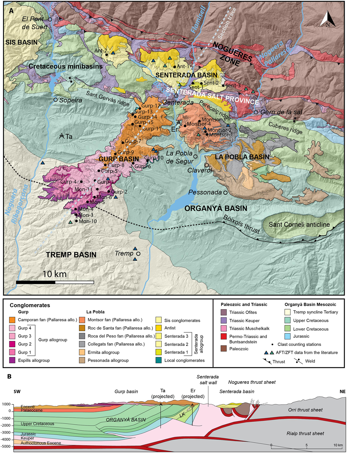
Fig. 2
Download original image
A. Detailed geological map of the study area showing the location of the clast counting stations. Ta: Tamúrcia well; Er: Erinyà well. The limits of the conglomerate fans are modified from the ICGC 1:25000 maps of Tremp and Espills for the Gurp basin, and from Saura (2004) and Barsó (2007) for the La Pobla and Senterada Basins. The Organyà Basin and the Nogueres Zone have been drawn from the ICGC 1:50000 map of the Pallars Jussà. The AFT/ZFT sample locations refer to the papers by Beamud et al., 2011, Whitchurch et al., 2011, Fillon et al., 2013, and Michael (2013). B. Schematic cross-section along the Gurp basin transect. LK, lower Cretaceous. The Organyà basin structure is modified from the sections in Mencos et al. (2015) and Muñoz et al. (2018), the Nogueres shallow structure is from Saura and Teixell (2006), and the deep structure of the antiformal stack is modified from Muñoz et al. (2018).
Current usage metrics show cumulative count of Article Views (full-text article views including HTML views, PDF and ePub downloads, according to the available data) and Abstracts Views on Vision4Press platform.
Data correspond to usage on the plateform after 2015. The current usage metrics is available 48-96 hours after online publication and is updated daily on week days.
Initial download of the metrics may take a while.