")
")
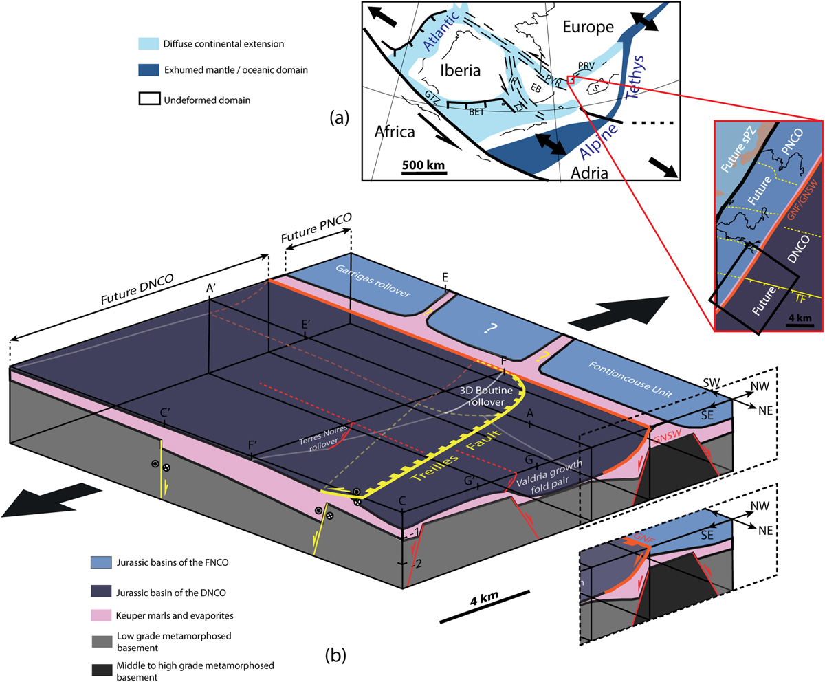
Fig. 14
Download original image
(a) End Dogger plate reconstruction of the Atlantic-Alpine Tethys linkage zone (adapted from Angrand et al., 2020), showing the location of the Corbières Virgation. Insert shows a schematic map of original Jurassic tectonostratigraphic zones of the study area (CLTZ in the Corbières Virgation portion). The box locates the block diagram in Figure 14b. Abbreviations are GTZ: Gibraltar Transfer Zone; BET: Bethic; IR: Iberian Range basins; EB: Ebro Block; PYR: Pyrenees; PRV: Provence; S: Sardigna. (b) Block diagram showing the restored 3D architecture of Jurassic basins of the future NCO, locating main documented features (Valdria forced folds, Treilles Fault, GNF, Garrigas, Boutine and Terres Noires rollovers). Extension in supra-salt cover was triggered by basement extension (in grey) but decoupled along Keuper evaporites (in pink). 2D to 3D salt and supra-salt structures and stratigraphic geometries (rollovers, forced folds, salt rollers) developed above oblique (NE-SW and N110) basement faults. Considering the NW-SE extension kinematics, the N110 structures are transtensionals. Two model hypothesis are shown for the original structure between the PNCO and the DNCO (GNF: Garrigas-Narbonne Fault or GNSW: Garrigas-Narbonne Salt Wall).
Les statistiques affichées correspondent au cumul d'une part des vues des résumés de l'article et d'autre part des vues et téléchargements de l'article plein-texte (PDF, Full-HTML, ePub... selon les formats disponibles) sur la platefome Vision4Press.
Les statistiques sont disponibles avec un délai de 48 à 96 heures et sont mises à jour quotidiennement en semaine.
Le chargement des statistiques peut être long.