")
")
Fig. 2
Download original image
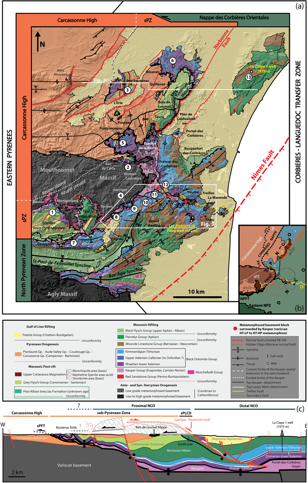
(a) Geological map of the Corbières Virgation, SW part of the Corbières-Languedoc Transfer Zone, showing the location of the study area (Fig. 5) and of the g”g’ cross-section. Jurassic stratigraphic columns of Figure 4 are located by number on the map. (b) Structural map of the Corbières Virgation showing the main orogenic domains and tectonic units defined in this paper. (c) E-W cross section of the Corbières Virgation (map trace located on Fig. 2a) showing the current relationship between the differents orogenic domains in the supra-salt cover (PNCO, DNCO, sPZ, Carcassonne high) (modified after Gorini et al., 1991). The section also illustrates the complex regional tectonic history and the decoupling effect of Keuper evaporites between supra-salt cover and sub-salt basement during deformations phases.
Current usage metrics show cumulative count of Article Views (full-text article views including HTML views, PDF and ePub downloads, according to the available data) and Abstracts Views on Vision4Press platform.
Data correspond to usage on the plateform after 2015. The current usage metrics is available 48-96 hours after online publication and is updated daily on week days.
Initial download of the metrics may take a while.