")
")
Fig. 8
Download original image
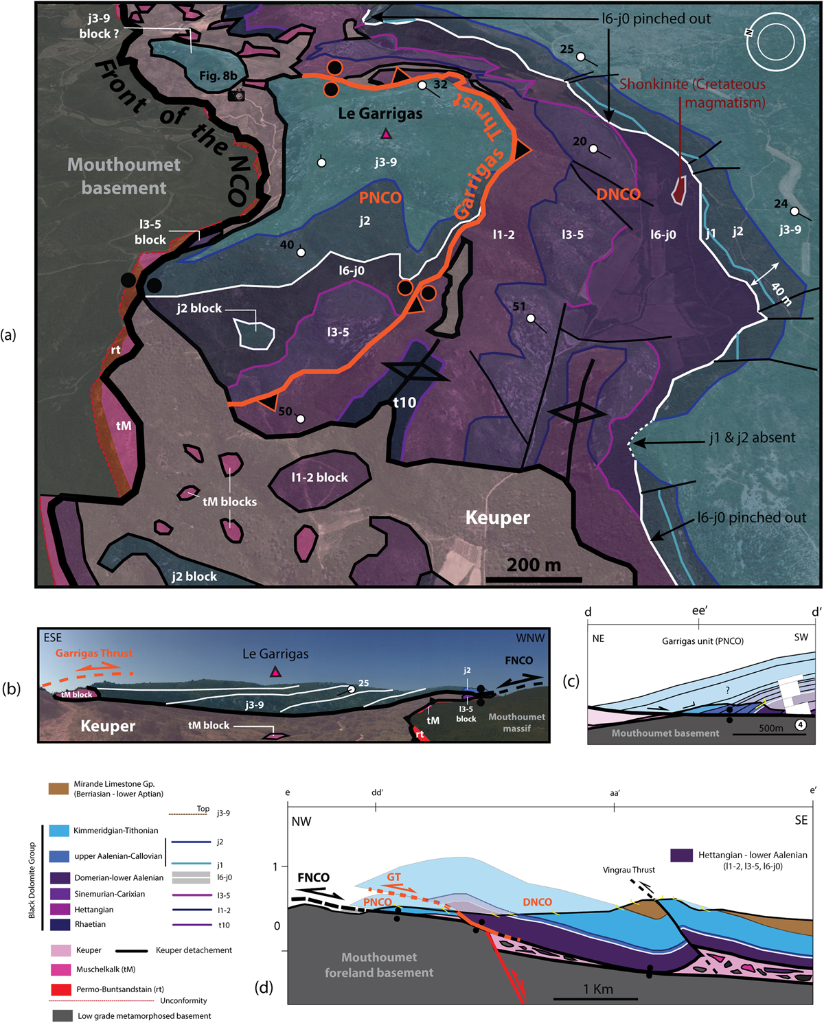
(a) Interpreted Google Earth view of the Garrigas area, showing the NCO detached above the Mouthoumet basement and the DNCO thrusting the PNCO toward NW along the Garrigas Thrust. The DNCO and the PNCO strata present opposite orientation. (b) Field view toward the SW of the Garrigas unit detached above Mouthoumet basement showing the downward plunge of Malm strata onto flat top Keuper detachement. (c) NE-SW trending dd’ cross-section of the Garrigas Jurassic rollover NW-SE oriented (map trace on Fig. 5) with a representation of the column 4 of the Figure 4. The tie points with section ee’ is indicated. (d) the NW-SE trending ee’ cross section (map trace on Fig. 5) showing the NCO detached above the Mouthoumet foreland basement, the DNCO thrusting the PNCO, and the NE termination of the Vingrau thrust and folds. The tie points with sections aa’ and dd’ is indicated.
Current usage metrics show cumulative count of Article Views (full-text article views including HTML views, PDF and ePub downloads, according to the available data) and Abstracts Views on Vision4Press platform.
Data correspond to usage on the plateform after 2015. The current usage metrics is available 48-96 hours after online publication and is updated daily on week days.
Initial download of the metrics may take a while.