")
")
Fig. 9
Download original image
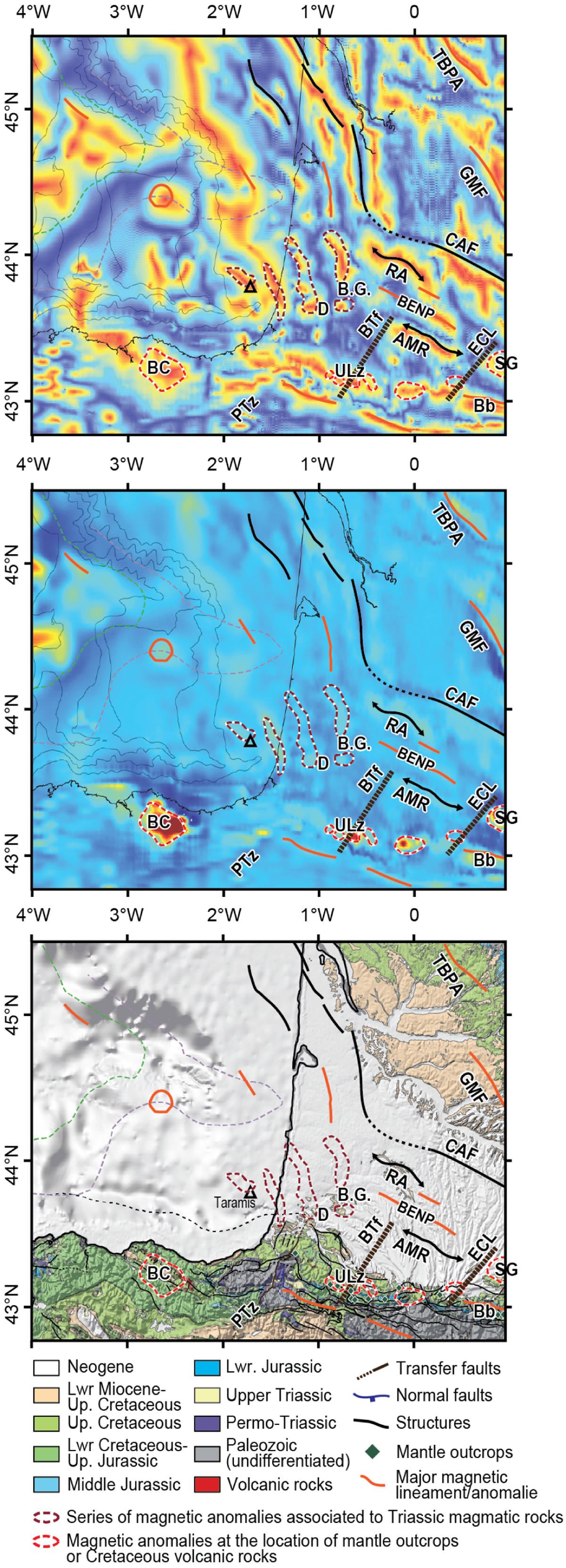
(A) Tilt angle magnetic map after RTP of the Aquitaine Margin and the Aquitaine Basin (domains VI and VII). (B)Vertical derivative magnetic map after RTP of the Aquitaine Margin and the Aquitaine Basin (domains VI and VII); (C) Simplified geological map of Pyrenees with major structures defined by magnetic signatures; Triangle: eruptive rocks sampled by Taramis well; AMR: Antin-Matourget ridge; Bb: Baronnie Basin; BC:Basque-Cantabrian anomaly; Pedreira et al., 2007); BG: Bastennes-Gaujacq; BTf: Barlanes transfer fault; CAF: Celtaquitain flexure (redrawn from the new magnetic compilation); D:Dax diapir; ECL: Eastern Crustal Lineament; BENP: Boundary between the European Necking and Proximal domains; GMF: Gavaudun-Monsempron Flexure; PTz: Pamplona Transfer Zone; RA: Roquefort Anticline; TBPA: Tour Blanche-Blessac and Périgueux Anticlines; fault; ULz: Urdach lerzolites; SG: Saint-Gaudens anomaly.
Current usage metrics show cumulative count of Article Views (full-text article views including HTML views, PDF and ePub downloads, according to the available data) and Abstracts Views on Vision4Press platform.
Data correspond to usage on the plateform after 2015. The current usage metrics is available 48-96 hours after online publication and is updated daily on week days.
Initial download of the metrics may take a while.