")
")
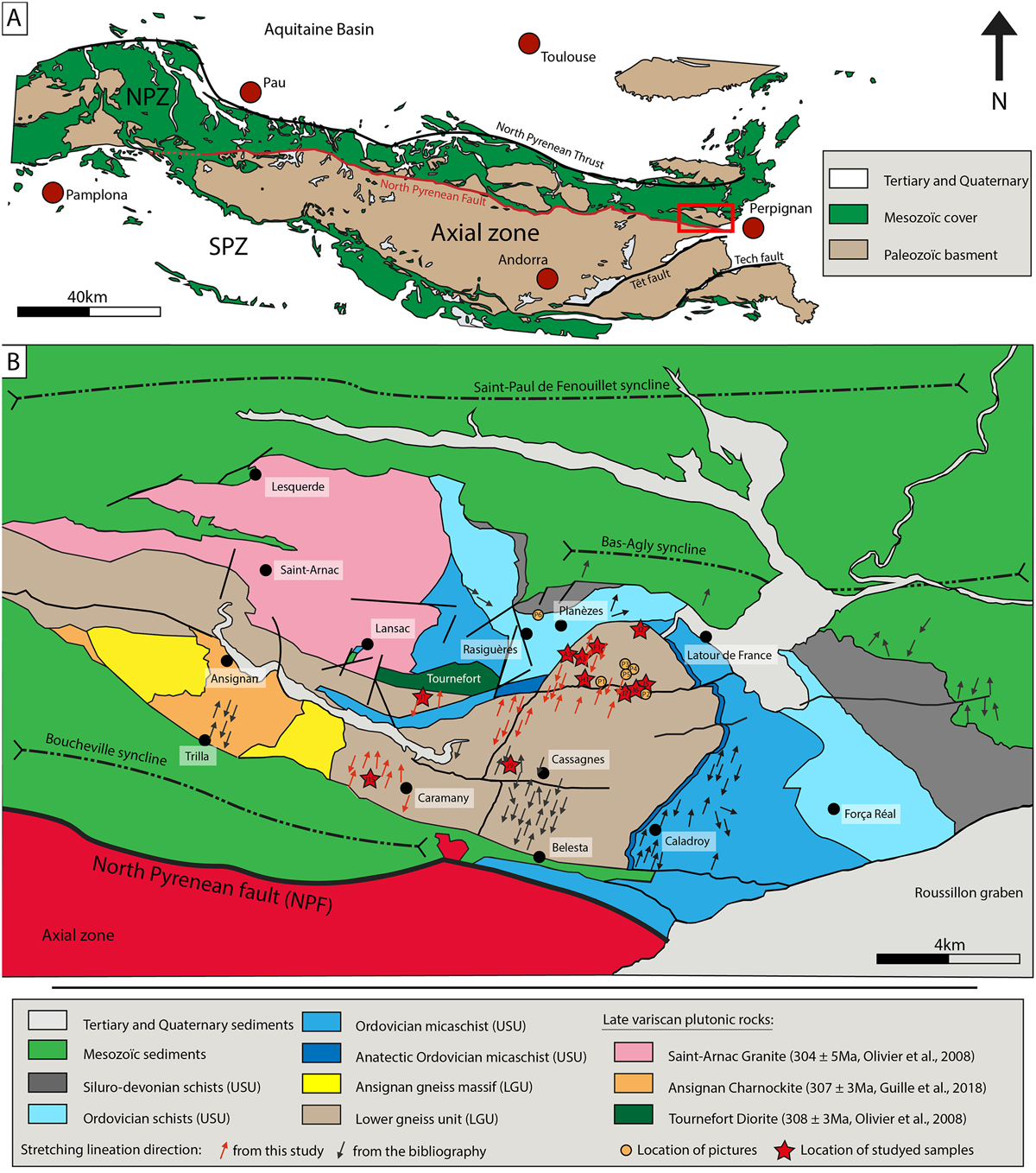
Fig. 1
Download original image
(A) Simplified geological map of the North Pyrenean Zone (NPZ) and location of the Agly Massif in the Pyrenean belt. (B) Geological map (modified from Fonteilles et al., 1993 and Berger et al., 1993) showing the location of the Agly Variscan Massif between the Saint Paul de Fenouillet and Bas Agly sedimentary basins to the north and the Boucheville sedimentary basin to the south. The North Pyrenean Fault (NPF) separates the Northern Pyrenean Zone from the Axial Zone. Stretching lineations from Delay (1989), Bouhallier et al. (1991), Choukroune et al., (1990), Vauchez et al., (2013) and this study.
Current usage metrics show cumulative count of Article Views (full-text article views including HTML views, PDF and ePub downloads, according to the available data) and Abstracts Views on Vision4Press platform.
Data correspond to usage on the plateform after 2015. The current usage metrics is available 48-96 hours after online publication and is updated daily on week days.
Initial download of the metrics may take a while.