")
")
Fig. 1
Download original image
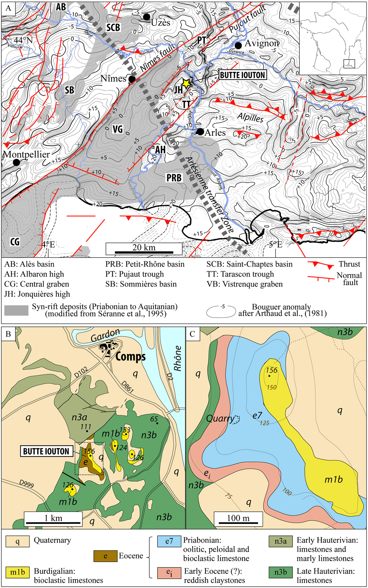
A) Simplified structural map of Languedoc and southern Rhône valley (SE France) (after Séranne et al., 2021; Mauffret and Gorini, 1996): the grey shaded areas indicate late Eocene to Aquitanian deposits (after Séranne et al., 1995; Séranne et al., 2021) and the background map displays the Bouguer anomaly (after Arthaud et al., 1981). B) Geological map of the Comps and Butte Iouton area, modified from the BRGM geological map, Nîmes sheet 1/50000 (Ménillet, 1973): the map shows the Eocene to Miocene outcrops and the Cretaceous substratum of the Jonquières high. C) Detailed geological map displaying the close-up view of the box around the butte Iouton hill in B).
Current usage metrics show cumulative count of Article Views (full-text article views including HTML views, PDF and ePub downloads, according to the available data) and Abstracts Views on Vision4Press platform.
Data correspond to usage on the plateform after 2015. The current usage metrics is available 48-96 hours after online publication and is updated daily on week days.
Initial download of the metrics may take a while.