")
")
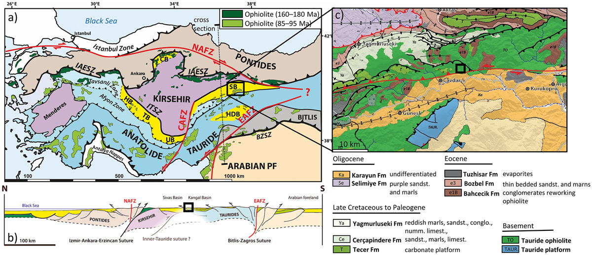
Fig. 1
Download original image
(a) A tectonic map of Turkey and the Eastern Mediterranean region illustrating major suture zones, faults systems, ophiolite outcrops, and tectonic units (Legeay et al., 2019). (b) N‒S cross-section showing the relationship between crustal blocks and ophiolites (Legeay et al., 2019). (c) A geological map of the Sivas Basin with the sampling zone indicated by a yellow point. The location of the sampling zone is illustrated by a black square (b, c). conglo.: conglomerate; limest.: limestone; numm.: nummulitic; sandst.: sandstone.
Current usage metrics show cumulative count of Article Views (full-text article views including HTML views, PDF and ePub downloads, according to the available data) and Abstracts Views on Vision4Press platform.
Data correspond to usage on the plateform after 2015. The current usage metrics is available 48-96 hours after online publication and is updated daily on week days.
Initial download of the metrics may take a while.