")
")
Fig. 2
Download original image
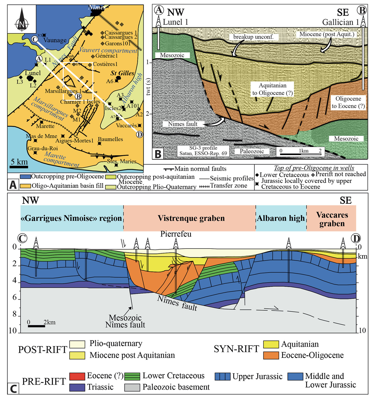
(A) Structural map of the Vistrenque Basin showing the location of the deep boreholes, modified after Benedicto et al.(1996). A101: Albaron 101 − A2: Albaron 2 − A3: Albaron 3 − A6: Albaron 6 − A7: Albaron 7 − A-Mortes 1 : Aigues-Mortes 1 − Aub: Aubord 1 − Char 1: Charnier 1 −Csg 1,2: Caissargues 1,2 − L1: Lunel 1 − L2: Lunel 2 − L3: Lunel 3 − LJ: La Jasette − M1: Montcalm 1 − M2: Montcalm 2 − P: Pierrefeu 1 − P: Pierrefeu 1 − Stes Maries: Saintes-Maries-de-la-Mer 101 − SV: Saint-Véran 1 − V3: Vaunage 3. t.z.: transfer zone. The rectangle shows the studied area (Pierrefeu and Gallician sectors, north and south to the transfer zone respectively) shown in the geographical map of Figure 3B. (B) Non-migrated seismic profile SG3 interpreted, after Benedicto (1996), location in (A) is indicated by the AB transect; (C) NW-SE cross-section through the Vistrenque Basin on the northern Vauvert compartment (modified after Benedicto et al., 1996, see location in A): CD transect).
Current usage metrics show cumulative count of Article Views (full-text article views including HTML views, PDF and ePub downloads, according to the available data) and Abstracts Views on Vision4Press platform.
Data correspond to usage on the plateform after 2015. The current usage metrics is available 48-96 hours after online publication and is updated daily on week days.
Initial download of the metrics may take a while.