")
")
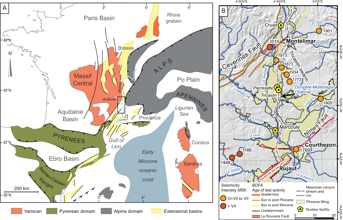
Fig. 1
Download original image
(A) Synthetic structural map of the study area (black box) showing the main tectonic domains mentioned in the text and the course of the Rhône and Ardèche rivers in dotted blue lines. (B) Seismotectonic map of the lower Rhône Valley between the Cévennes Fault and Nîmes Fault. Plotted historical earthquakes are from SisFrance Database (www.sisfrance.net: data from SisFrance, BRGM, EDF, IRSN, 2022), magnitudes from FCAT (Mw catalog − Manchuel et al., 2018). BDFA refers to the Potentially Active Fault Database (Jomard et al., 2017), paleoseismological works reported in Baize et al. (2002) and Bellier et al. (2021).
Current usage metrics show cumulative count of Article Views (full-text article views including HTML views, PDF and ePub downloads, according to the available data) and Abstracts Views on Vision4Press platform.
Data correspond to usage on the plateform after 2015. The current usage metrics is available 48-96 hours after online publication and is updated daily on week days.
Initial download of the metrics may take a while.