")
")
Fig. 7
Download original image
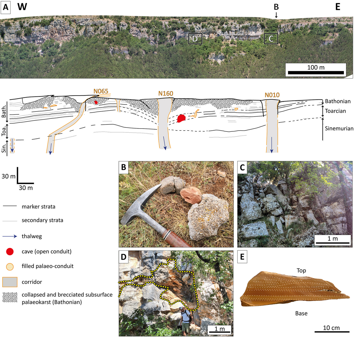
A. Photomosaic extracted from the orthophotograph survey conducted on the upper scarp of the Cirque du Bout du Monde (location shown in Figure 6 as Cirque B.d.M.) using a drone. The easternmost vertical corridor aligns vertically with the flat-bottom valley observed on the surface (illustrated in Figure 6), implying that in cross-section the dry valley presents a corridor structure. The stratigraphy is based on Charcosset et al. (2000). Vertical corridors extend across the entire scarp and change into thalweg in the forested slope without offsetting beddings. Note that the western corridor, vertical and oriented N065, is obliquely cut by the scarp. B. Ferruginous sandstone and microconglomerate blocks found on the surface within the dry valley (shown in Figure 6). C. The corridor’s centre consists of breccia with divided blocks that keep their initial positions or have collapsed. D. Metre-scale palaeo-conduit (yellow dotted line) filled with lithified laminated sediment. This palaeo-conduit develops within a vertical discontinuity and a bedding plane. E. Laminated lithified sediment found in corridors centre between blocks and within palaeo-conduits. These finely laminated siltstones exhibit cross-bedding, indicating sediment deposition by hydrodynamic processes.
Current usage metrics show cumulative count of Article Views (full-text article views including HTML views, PDF and ePub downloads, according to the available data) and Abstracts Views on Vision4Press platform.
Data correspond to usage on the plateform after 2015. The current usage metrics is available 48-96 hours after online publication and is updated daily on week days.
Initial download of the metrics may take a while.