")
")
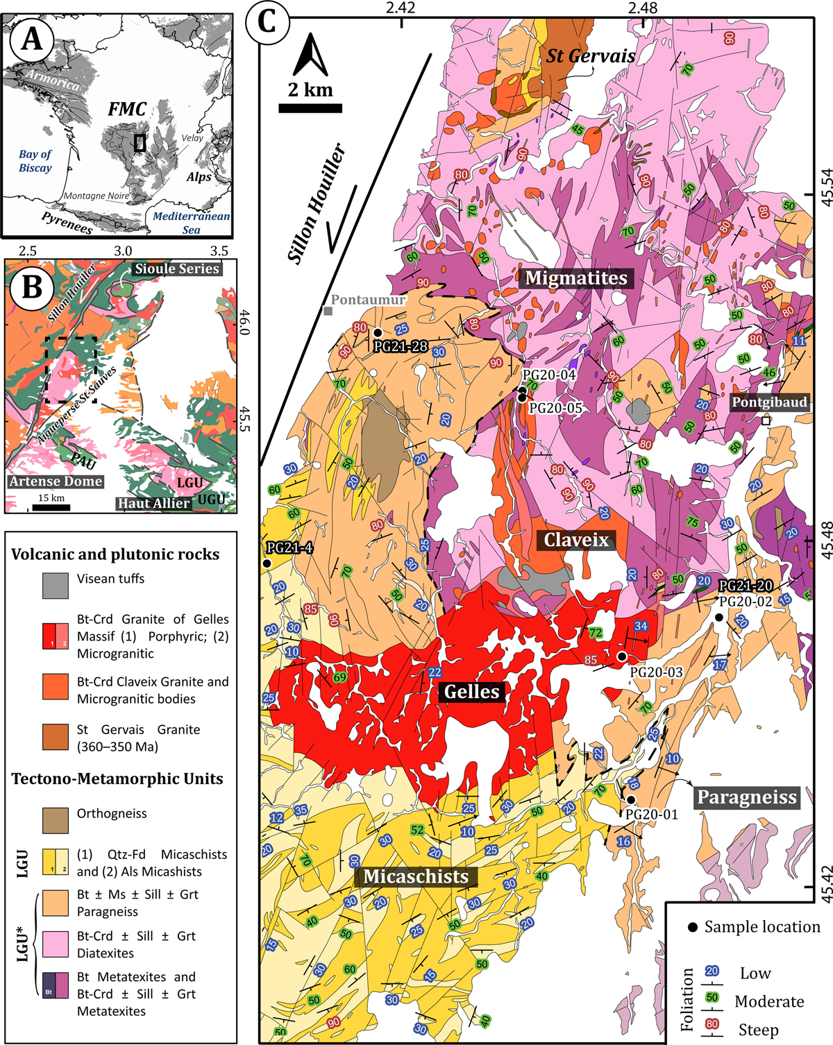
Fig. 1
Download original image
(a) General context of the French Massif Central. (b) Sketch map of the Variscan basement of the Pontgibaud region showing the spatial distribution of LGU, UGU and PAU units, and localities where these nappes were defined (Sioule Series, Artense Dome and Haut Allier). Modified after Chantraine et al., (2003). (c) Geological map of the Pontgibaud region. The dashed black line represents the UGU/LGU contact proposed by Chantraine et al. (2003). Note that paragneiss are either attributed to LGU (north-west of Gelles granite) or UGU (south-east of Gelles granite). Modified after Hottin et al., (1989).
Current usage metrics show cumulative count of Article Views (full-text article views including HTML views, PDF and ePub downloads, according to the available data) and Abstracts Views on Vision4Press platform.
Data correspond to usage on the plateform after 2015. The current usage metrics is available 48-96 hours after online publication and is updated daily on week days.
Initial download of the metrics may take a while.