")
")
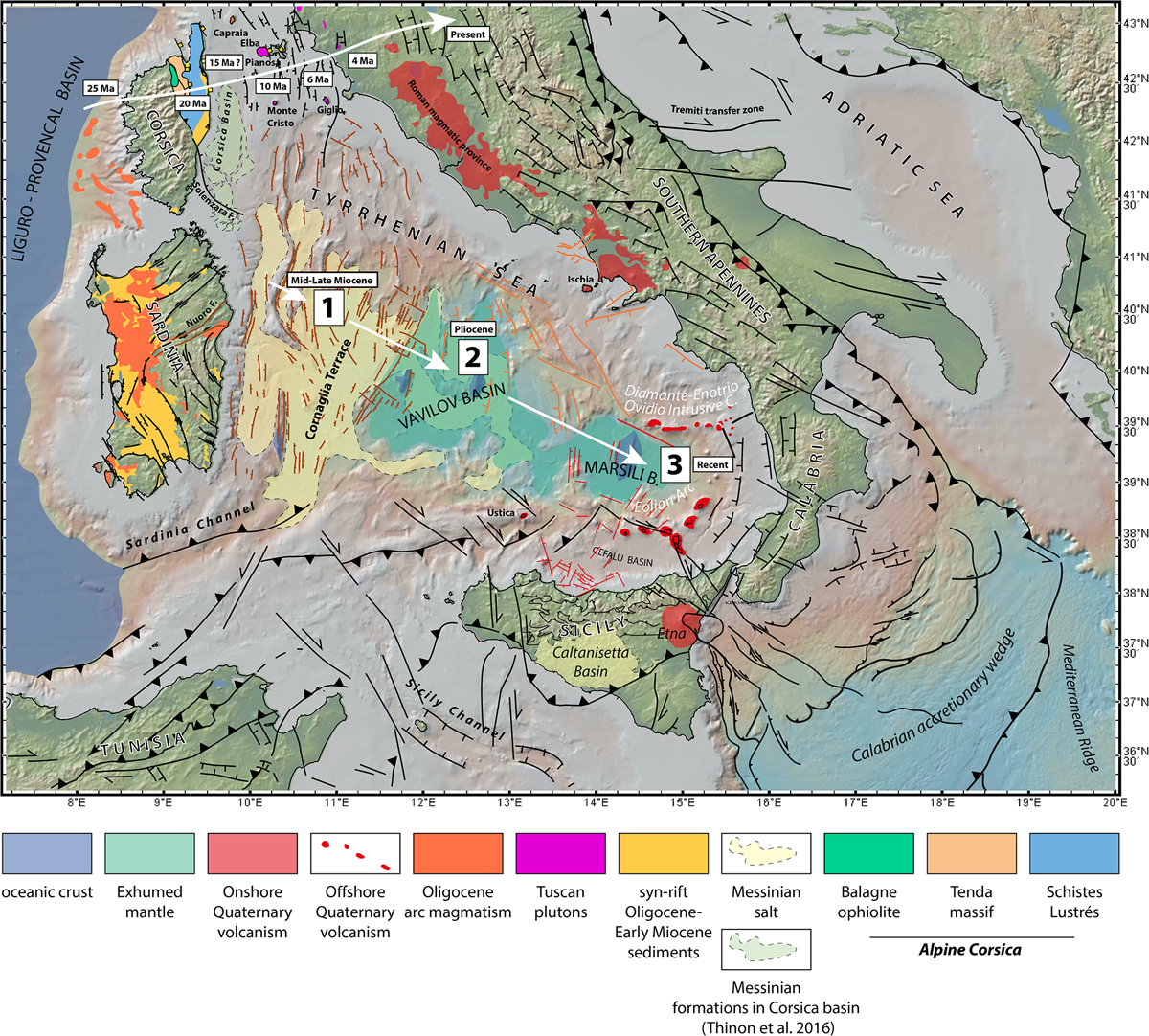
Fig. 5
Download original image
Compiled structural map of the Tyrrhenian Sea and surrounding regions (Jolivet et al., 1990, 1998; Keller and Pialli, 1990; Roure et al., 1990; Daniel and Jolivet, 1995; Mascle and Chaumillon, 1997; Brunet et al., 2000; Bruno et al., 2000; Collettini and Holdsworth, 2004; Sartori et al., 2004; Billi et al., 2006, 2007, 2011; Catalano et al., 2013; Presti et al., 2013; Prada et al., 2014, 2016, 2018; Gasparo Morticelli et al., 2015; Liotta et al., 2015; Lymer et al., 2016; Polonia et al., 2016; Thinon et al., 2016; Conti et al., 2017; Gutscher et al., 2017; Milia et al., 2018; De Ritis et al., 2019; Loreto et al., 2019; Zitellini et al., 2019; Haq et al., 2020). Bathymetry and topography from GeoMapApp (Ryan et al., 2009).
Current usage metrics show cumulative count of Article Views (full-text article views including HTML views, PDF and ePub downloads, according to the available data) and Abstracts Views on Vision4Press platform.
Data correspond to usage on the plateform after 2015. The current usage metrics is available 48-96 hours after online publication and is updated daily on week days.
Initial download of the metrics may take a while.