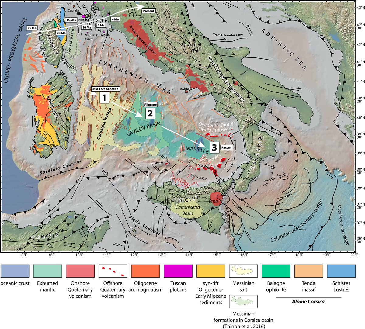
Fig. 5

Download original image
Compiled structural map of the Tyrrhenian Sea and surrounding regions (Jolivet et al., 1990, 1998; Keller and Pialli, 1990; Roure et al., 1990; Daniel and Jolivet, 1995; Mascle and Chaumillon, 1997; Brunet et al., 2000; Bruno et al., 2000; Collettini and Holdsworth, 2004; Sartori et al., 2004; Billi et al., 2006, 2007, 2011; Catalano et al., 2013; Presti et al., 2013; Prada et al., 2014, 2016, 2018; Gasparo Morticelli et al., 2015; Liotta et al., 2015; Lymer et al., 2016; Polonia et al., 2016; Thinon et al., 2016; Conti et al., 2017; Gutscher et al., 2017; Milia et al., 2018; De Ritis et al., 2019; Loreto et al., 2019; Zitellini et al., 2019; Haq et al., 2020). Bathymetry and topography from GeoMapApp (Ryan et al., 2009).
Les statistiques affichées correspondent au cumul d'une part des vues des résumés de l'article et d'autre part des vues et téléchargements de l'article plein-texte (PDF, Full-HTML, ePub... selon les formats disponibles) sur la platefome Vision4Press.
Les statistiques sont disponibles avec un délai de 48 à 96 heures et sont mises à jour quotidiennement en semaine.
Le chargement des statistiques peut être long.


