")
")
Fig. 1
Download original image
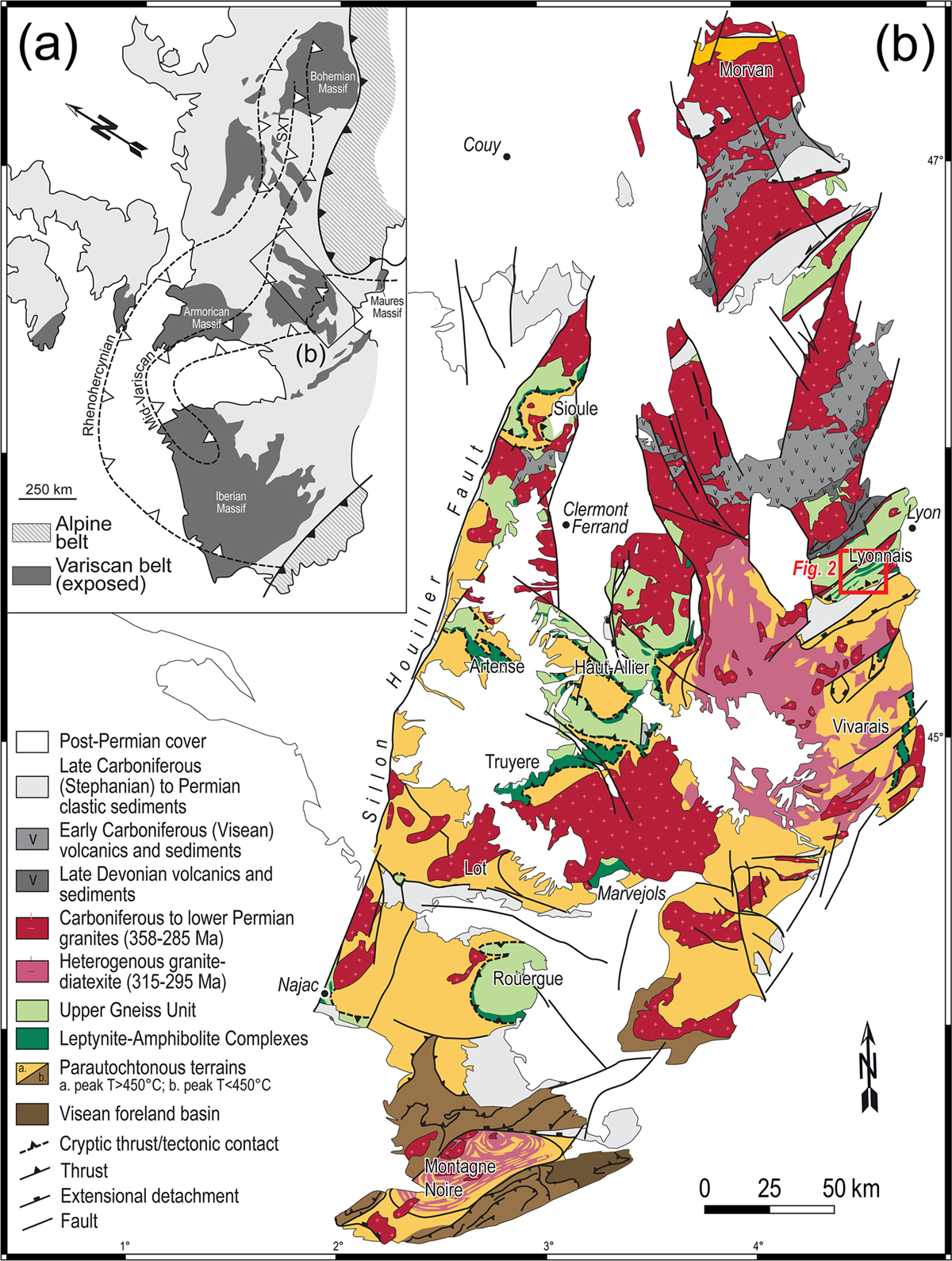
(a) Sketch map depicting the exposed Variscan domains of western Europe and the location of the inferred suture zones, based on Schulmann et al. (2022). SXT: Saxo-Thuringian suture. (b) Geological map of the eastern French Massif Central showing the main nappe architecture. Are also depicted the locations/names of “Leptynite-Amphibolite Complex” occurrences (in black), adapted from Chantraine et al. (2003).
(a) Carte simplifiée montrant les zones où affleurent les terrains varisques et les sutures supposées. (b) Carte géologique de l’Est du Massif Central français oriental localisant les zones où affleure les "complexes leptyno-amphiboliques".
Current usage metrics show cumulative count of Article Views (full-text article views including HTML views, PDF and ePub downloads, according to the available data) and Abstracts Views on Vision4Press platform.
Data correspond to usage on the plateform after 2015. The current usage metrics is available 48-96 hours after online publication and is updated daily on week days.
Initial download of the metrics may take a while.