")
")
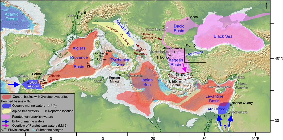
Fig. 1
Download original image
Map of the Mediterranean Basin s.l. with a sketch of the paleogeographic context during the second (paroxysmal) step of the Messinian Crisis, with a focus on the evaporites in the central basins (Haq et al., 2020), the isolated (perched) basins (West Alboran: Booth-Rea et al., 2018; Apennine Foredeep: Pellen et al., 2017, 2021; Eastern Paratethys including the Aegean Basin: Popescu et al., 2015; Suc et al., 2015a), the fluvial canyons (Bache et al., 2012; Pellen et al., 2019; addition references in the Supplementary material), and the submarine canyons in the Southeastern Levantine Basin (Buchbinder and Zilberman, 1997; Moneron and Gvirtzman, 2022). The map is elaborated using GeoMapApp (Ryan et al., 2009).
Carte de la Méditerranée s.l. dans le contexte paléogéographique du second stade (paroxysmal) de la Crise messinienne.
Current usage metrics show cumulative count of Article Views (full-text article views including HTML views, PDF and ePub downloads, according to the available data) and Abstracts Views on Vision4Press platform.
Data correspond to usage on the plateform after 2015. The current usage metrics is available 48-96 hours after online publication and is updated daily on week days.
Initial download of the metrics may take a while.