")
")
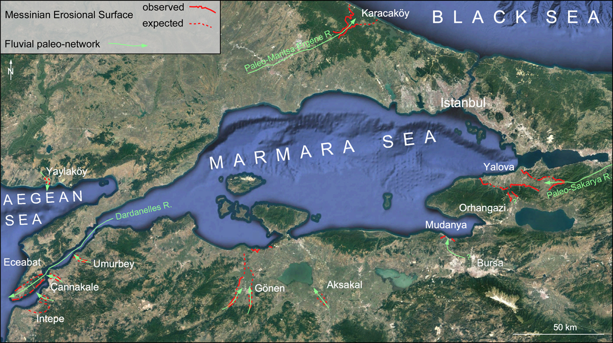
Fig. 10
Download original image
Google Earth map of the Marmara region with the outline of the MES filled by Gilbert-type fan deltas and sketch of the fluvial network at the peak of the MC. The studied locations with calcareous nannoplankton age for most of them are shown in Figure S1. Sketch of the MES comes from Melinte-Dobrinescu et al. (2009) and Suc et al. (2015b). This figure includes the new data presented in this paper.
Carte Google Earth de la région de Marmara avec dessin de la Surface d’érosion messinienne, des Gilbert deltas qui remplissent les vallées messiniennes et du réseau fluviatile lors du paroxysme de la Crise messinienne.
Current usage metrics show cumulative count of Article Views (full-text article views including HTML views, PDF and ePub downloads, according to the available data) and Abstracts Views on Vision4Press platform.
Data correspond to usage on the plateform after 2015. The current usage metrics is available 48-96 hours after online publication and is updated daily on week days.
Initial download of the metrics may take a while.