")
")
Fig. 5
Download original image
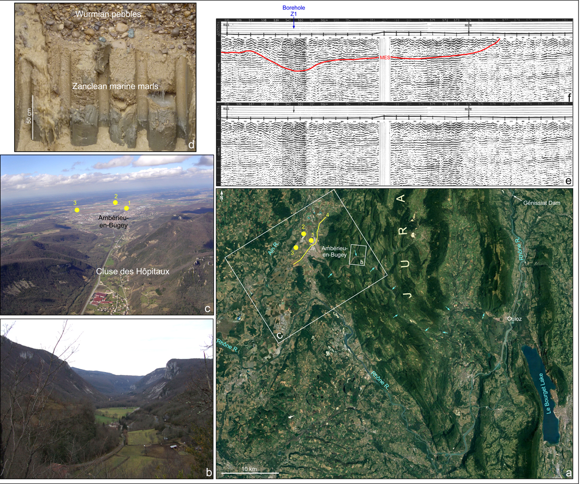
New data from the Rhône Messinian Erosional Surface far in the hinterland. a, Google Earth view in the southern Jura Mountains area (see Fig. 1). The Messinian paleovalley is tagged by blue arrows. 1, Borehole Z1 in the Air Base 278; 2, Château-Gaillard Quarry; 3, Cormoz 1 borehole; 4, Location of the seismic profile 14 from the 16-0184 survey. b, Transverse view of the Cluse des Hôpitaux. The Messinian erosion should correspond to the uppermost 30-40 metres of the uplifted Jurassic cliffs. c, Aerial view of the outlet of the Cluse des Hôpitaux. Legend: see Fig. a. d, Section of the Château-Gaillard Quarry. e, Uninterpreted seismic profile 14. f, Interpreted seismic profile 14. Red line: Messinian Erosional Surface (MES). Photographs: b by J.-P. Suc; c by B. Chirol; d by P. Sorrel.
Données nouvelles sur la Surface d’érosion messinienne du Rhône loin à l’intérieur des terres.
Current usage metrics show cumulative count of Article Views (full-text article views including HTML views, PDF and ePub downloads, according to the available data) and Abstracts Views on Vision4Press platform.
Data correspond to usage on the plateform after 2015. The current usage metrics is available 48-96 hours after online publication and is updated daily on week days.
Initial download of the metrics may take a while.