")
")
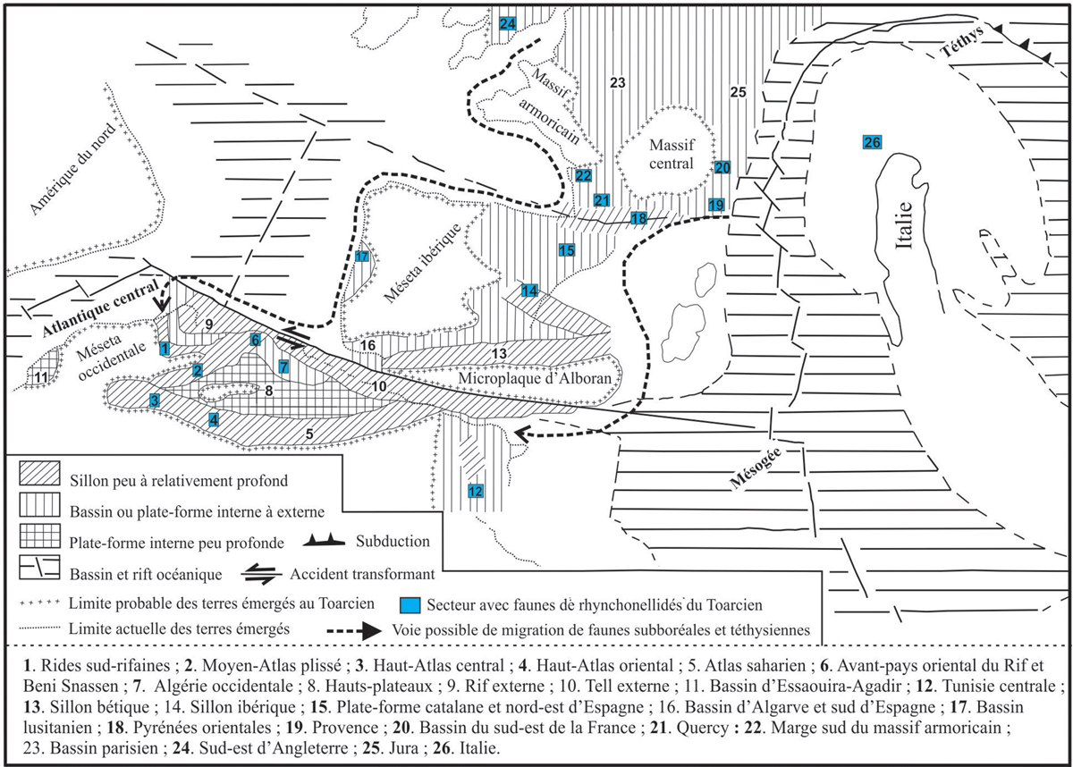
Fig. 11
Download original image
Carte paléogéographique de l’Afrique du nord et l’Europe du sud-ouest au passage jurassique inférieur-jurassique moyen montrant la répartition des domaines continentaux et marins et les bassins péritéthysiens à faune de brachiopodes de l’ordre des Rhynchonelida (Carte in: Faugères et Mouterde, 1979, modifiée).
Paleogeographic map of North Africa and southwest Europe at the Lower-Middle Jurassic boundary showing the distribution of the continental and marine domains and the peritethyan basins with brachiopod fauna of the order Rhynchonelida (Map after Faugères and Mouterde, 1979, modified).
Current usage metrics show cumulative count of Article Views (full-text article views including HTML views, PDF and ePub downloads, according to the available data) and Abstracts Views on Vision4Press platform.
Data correspond to usage on the plateform after 2015. The current usage metrics is available 48-96 hours after online publication and is updated daily on week days.
Initial download of the metrics may take a while.