")
")
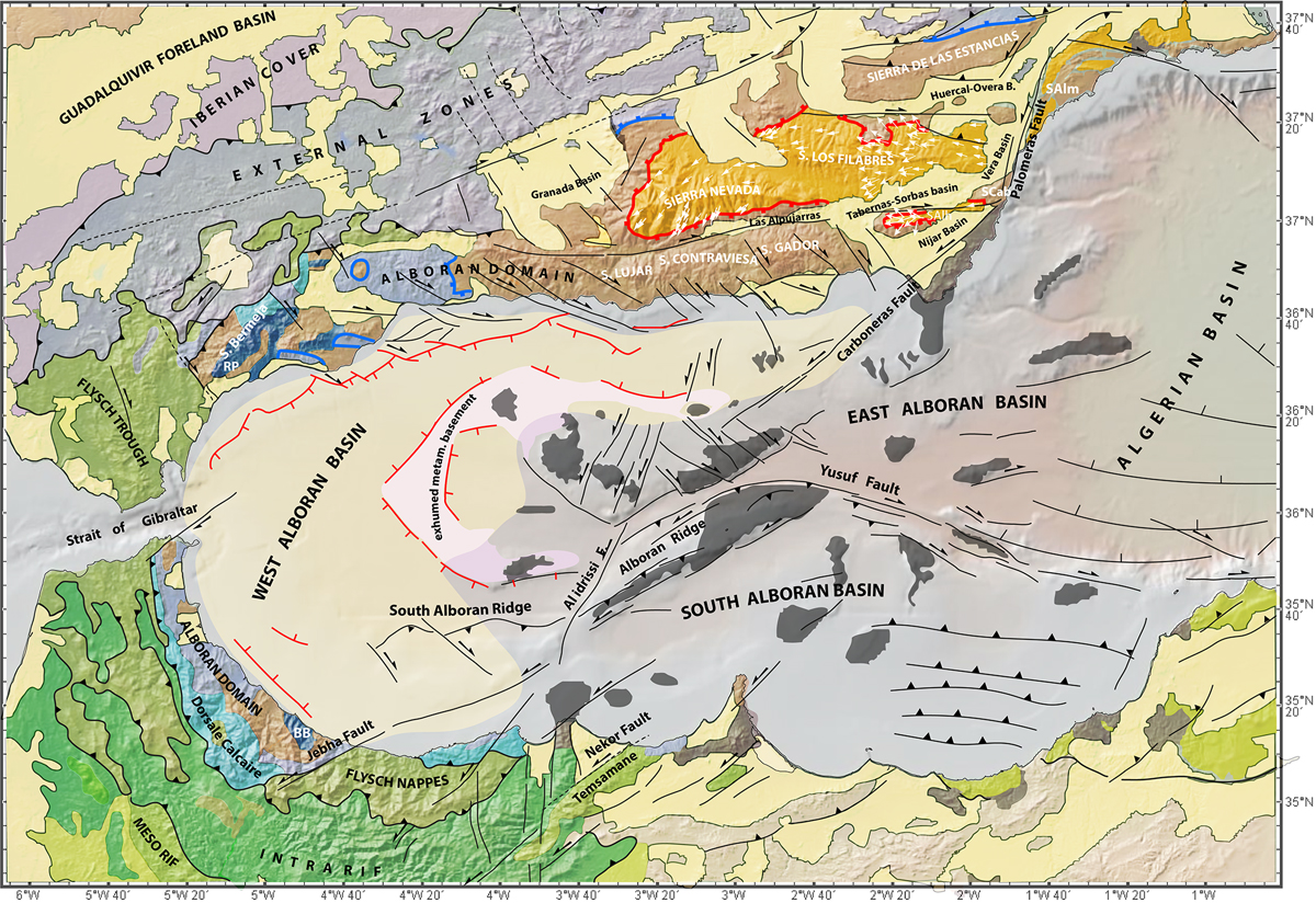
Fig. 6
Download original image
Tectonic map of the Alboran region (Comas et al., 1999; Augier et al., 2005a, 2005b; Chalouan et al., 2008; Medaouri et al., 2014; Crespo-Blanc et al., 2016; Do Couto et al., 2015; Martinez-Garcia et al., 2017; d’Acremont et al., 2020; Lafosse et al., 2020). Bathymetry and topography from GeoMapApp (Ryan et al., 2009). RP: Ronda peridotite massif, BB: Beni Bousera peridotite massif. The thick blue line represents the Malaguide-Alpujarride Contact Detachment and the thick red line the Filabres and Mecina Detachments between the Alpujarride and Nevado-Filabride complexes. Thin red lines are the offshore syn-rift normal faults.
Current usage metrics show cumulative count of Article Views (full-text article views including HTML views, PDF and ePub downloads, according to the available data) and Abstracts Views on Vision4Press platform.
Data correspond to usage on the plateform after 2015. The current usage metrics is available 48-96 hours after online publication and is updated daily on week days.
Initial download of the metrics may take a while.