")
")
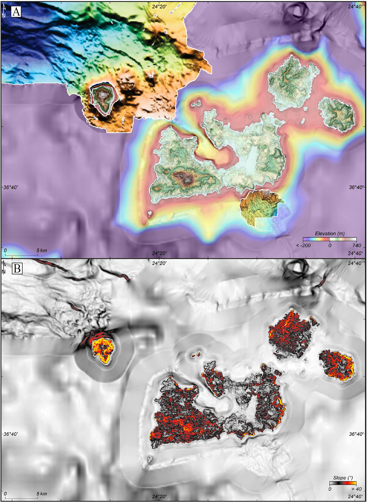
Fig. 4
Download original image
(A) Topo-bathymetric and relief map of the Milos Archipelago derived from GEBCO data and completed with the bathymetric map of Nomikou et al. (2014). (B) Associated slope map derived from GEBCO data and including Antimilos, Kimolos and Polyegos. Both maps were used in addition to the cited literature to construct the synoptic structural sketch in Figure 5.
(A) Carte topo-bathymétrique de l’archipel de Milos dérivée des données GEBCO et complétée par la carte bathymétrique de Nomikou et al. (2014). (B) Carte des pentes associée dérivée des données GEBCO et incluant Antimilos, Kimolos et Polyegos. Les deux cartes ont été utilisées en complément de la littérature citée pour construire le schéma structural synoptique de la Figure 5.
Current usage metrics show cumulative count of Article Views (full-text article views including HTML views, PDF and ePub downloads, according to the available data) and Abstracts Views on Vision4Press platform.
Data correspond to usage on the plateform after 2015. The current usage metrics is available 48-96 hours after online publication and is updated daily on week days.
Initial download of the metrics may take a while.