")
")
Fig. 2
Download original image
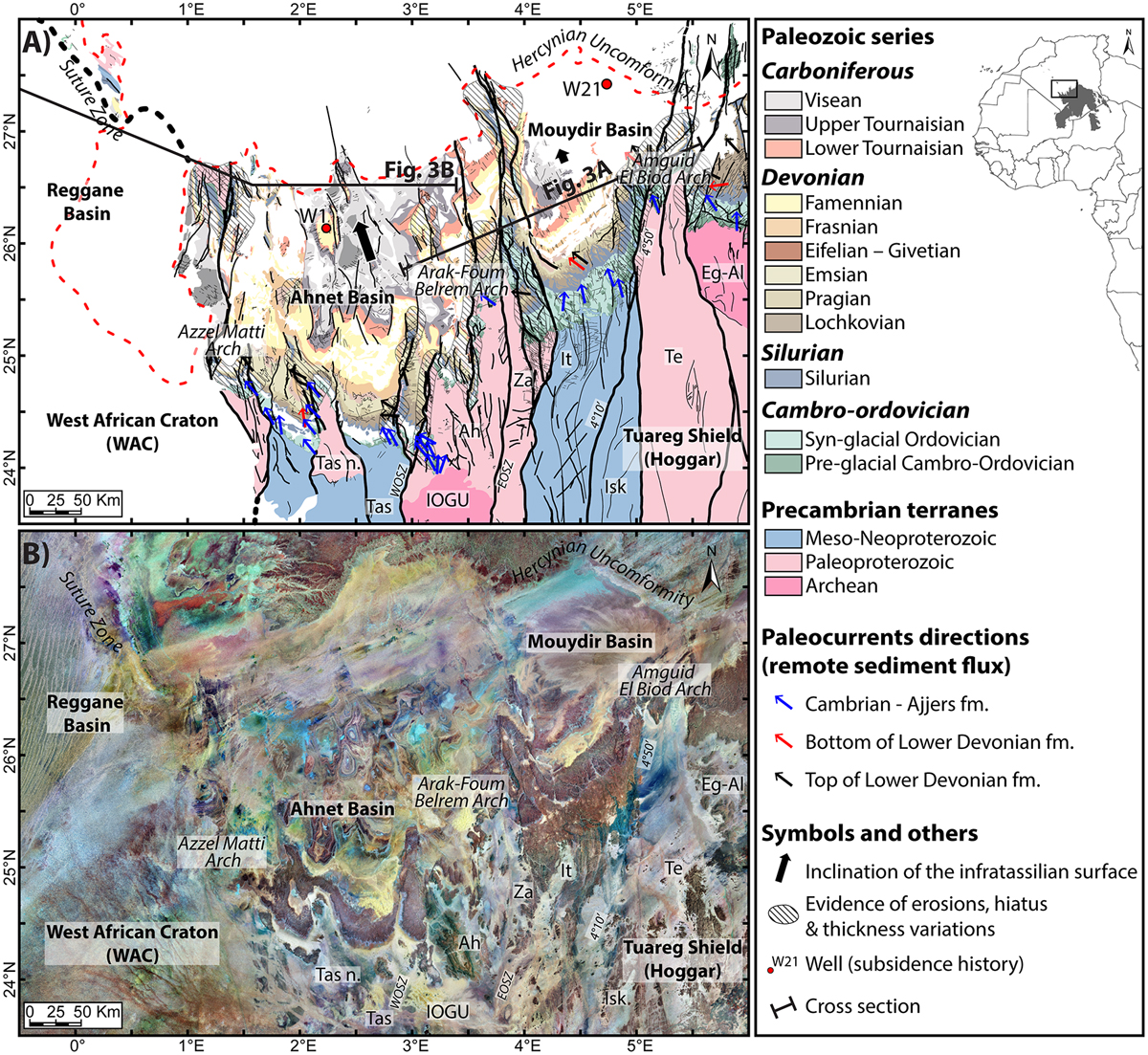
(A) Geological map of the Ahnet and the Mouydir Basins modified from Perron et al., (2018) showing the specific zonation of the terranes, the paleocurrents directions (from Beuf et al., 1971) and the evidence of sedimentary structures on arches (from Perron et al., 2018; Wendt et al., 2006). Terrane names and abbreviations: Tassendjanet (Tas), Tassendjanet nappe (Tas n.), Ahnet (Ah), In Ouzzal Granulitic Unit (IOGU), In Zaouatene (Za), In Teidini (It), Iskel (Isk), Tefedest (Te) and Egéré-Aleskod (Eg-Al). Shear zone and lineament names and abbreviations: west Ouzzal shear zone (WOSZ), east Ouzzal shear zone (EOSZ), 4°10’ shear zone and 4°50’ shear zone. B) Satellite images of the Paleozoic series in the Ahnet and Mouydir basin (Landsat 7 ETM + from USGS: https://earthexplorer.usgs.gov/).
Current usage metrics show cumulative count of Article Views (full-text article views including HTML views, PDF and ePub downloads, according to the available data) and Abstracts Views on Vision4Press platform.
Data correspond to usage on the plateform after 2015. The current usage metrics is available 48-96 hours after online publication and is updated daily on week days.
Initial download of the metrics may take a while.