")
")
Fig. 11
Download original image
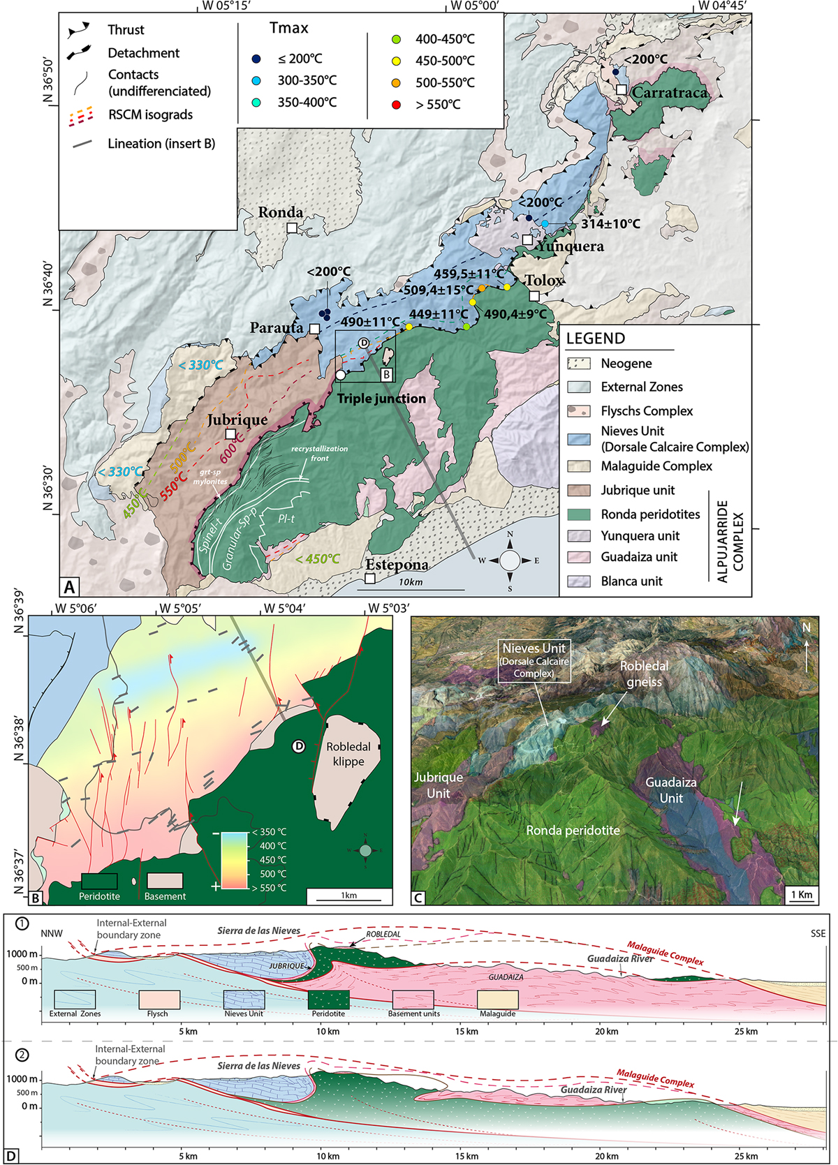
Synthesis of the work of Bessière (2019) in the vicinity of the Ronda peridotite massif and its contact with the Nieves (Dorsale Calcaire) unit. A: General map of the Los Reales peridotite, Jubrique unit and Nieves unit. Isograds and characteristic temperatures are shown. Petrological and deformation domains in the peridotites are indicated in grey after Lenoir et al. (2001). Pl-t: plagioclase-tectonite, granular-sp-p: granular spinel peridotite, spinel-t: spinel tectonites, grt-sp mylonites: garnet-spinel mylonites. B: map of the triple junction between the peridotite, Jubrique unit and Nieves unit with stretching lineations and peak temperatures (RSCM method). C: 3D view of the same region draped on a Google Earth image showing the complexity of the geometry of the contact between the peridotite, Guadaiza unit and Jubrique unit. D: comparison of two end-member cross-sections with Guadaiza unit either underneath (Lundeen, 1978) or on top of the peridotite (Sanz de Galdeano, 2017). In the upper section Robledal and Jubrique units form a single entity while Guadaiza unit is a separate unit; in the lower section, Guadaiza, Robledal and Jubrique units are parts of a single unit. Caution: note that the western contact of the peridotite is decorated by indications of a detachment, which is our final interpretation at the time of formation of the Nieves-Los-Reales Shear Zone but the present-day position of the peridotite-Nieves contact is a steep fault putting the peridotite on top of Nieves Unit.
Current usage metrics show cumulative count of Article Views (full-text article views including HTML views, PDF and ePub downloads, according to the available data) and Abstracts Views on Vision4Press platform.
Data correspond to usage on the plateform after 2015. The current usage metrics is available 48-96 hours after online publication and is updated daily on week days.
Initial download of the metrics may take a while.