")
")
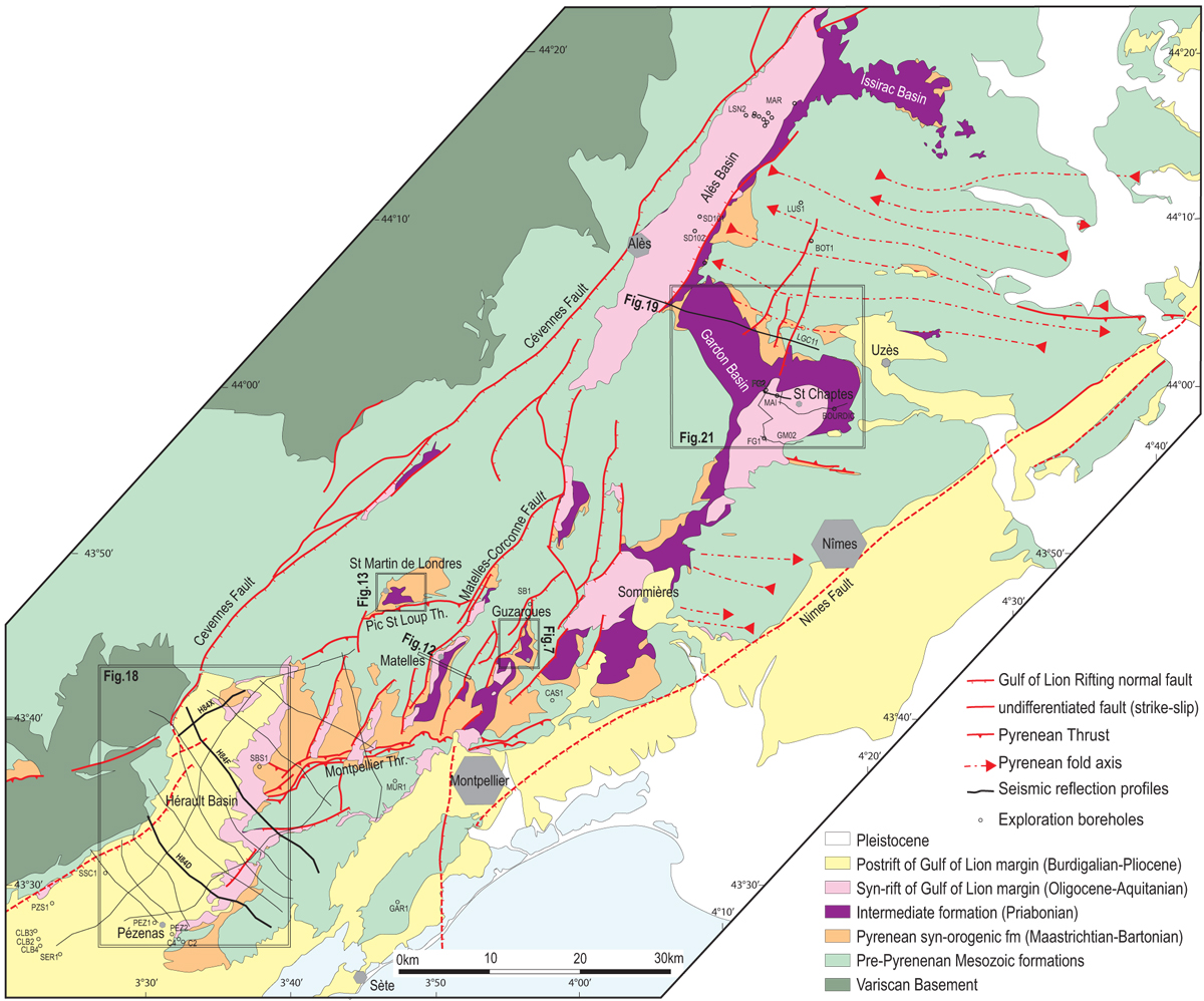
Fig. 2
Download original image
Simplified geological map of Languedoc, in the northern foreland of the Provence-Pyrénées fold and thrust belt. See location in the regional structural framework of Figure 1. Priabonian basins according to the present study, in some areas, stratigraphic attributions are different from the BRGM 1/50 000-scale geological maps (see text for explanation). Subsurface data used in the study is indicated fine black lines (seismic) and open circles (boreholes); seismic profiles shown in this contribution are in bolder black line. Location of detailed maps and sections is shown with double black line frames.
Current usage metrics show cumulative count of Article Views (full-text article views including HTML views, PDF and ePub downloads, according to the available data) and Abstracts Views on Vision4Press platform.
Data correspond to usage on the plateform after 2015. The current usage metrics is available 48-96 hours after online publication and is updated daily on week days.
Initial download of the metrics may take a while.