")
")
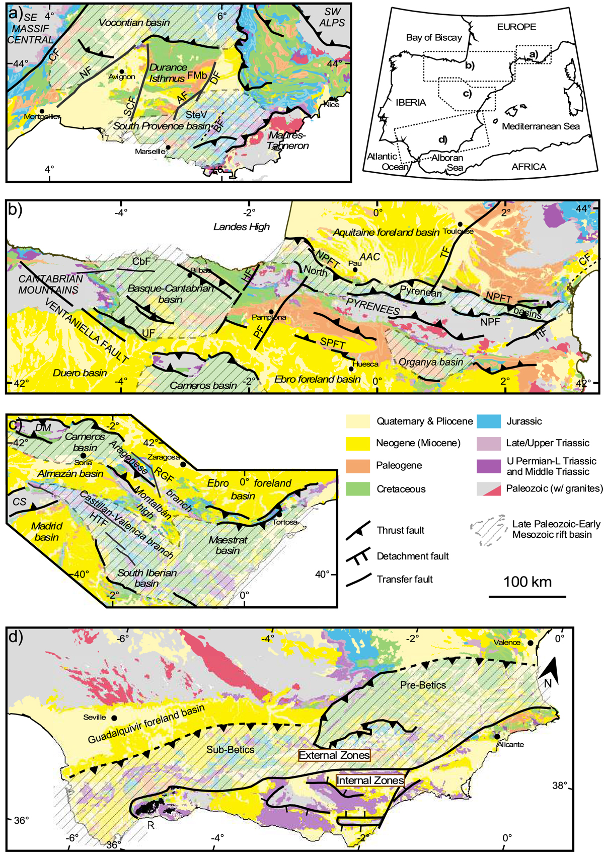
Fig. 3
Download original image
Detailed geological maps of the main deformed areas used in this study, highlyting the main structures (thrust fronts, normal faults, strike-slip faults) and structural domains. (a) Provence domain. CF: Cévennes Fault; NF: Nîme Fault; SCF: Salon-Cavaillon Fault; AF: Aix Fault; BF: Barjols Fault; DF: Durance Fault; FMb: Forcalquier-Manosque basin; SteV: Sainte Victoire. Note that normal faults described in the text are to small to be shown on the map. (b) Pyrenees and Basque-Cantabrian domains. CbF: Carbuerniga Fault; UF: Ubernia Fault, HF: Hendaye Fault; PF: Pamplona Fault; NPFT: North Pyrenean Frontal Thrust; NPF: North Pyrenean Fault; TF: Toulouse Fault; TtF: Têt Fault; CF: Cévennes Fault; AAC: Adour-Arzacq-Comminges basin. (c) Iberian Range. CS: Central System; DM: Demanda Massif; HTF: High Tagus Fault, RGF: Rio Grio Fault. (d) Betic domain. R: Ronda peridotite. Note the different orientation of this map, indicated by the North arrow.
Current usage metrics show cumulative count of Article Views (full-text article views including HTML views, PDF and ePub downloads, according to the available data) and Abstracts Views on Vision4Press platform.
Data correspond to usage on the plateform after 2015. The current usage metrics is available 48-96 hours after online publication and is updated daily on week days.
Initial download of the metrics may take a while.