")
")
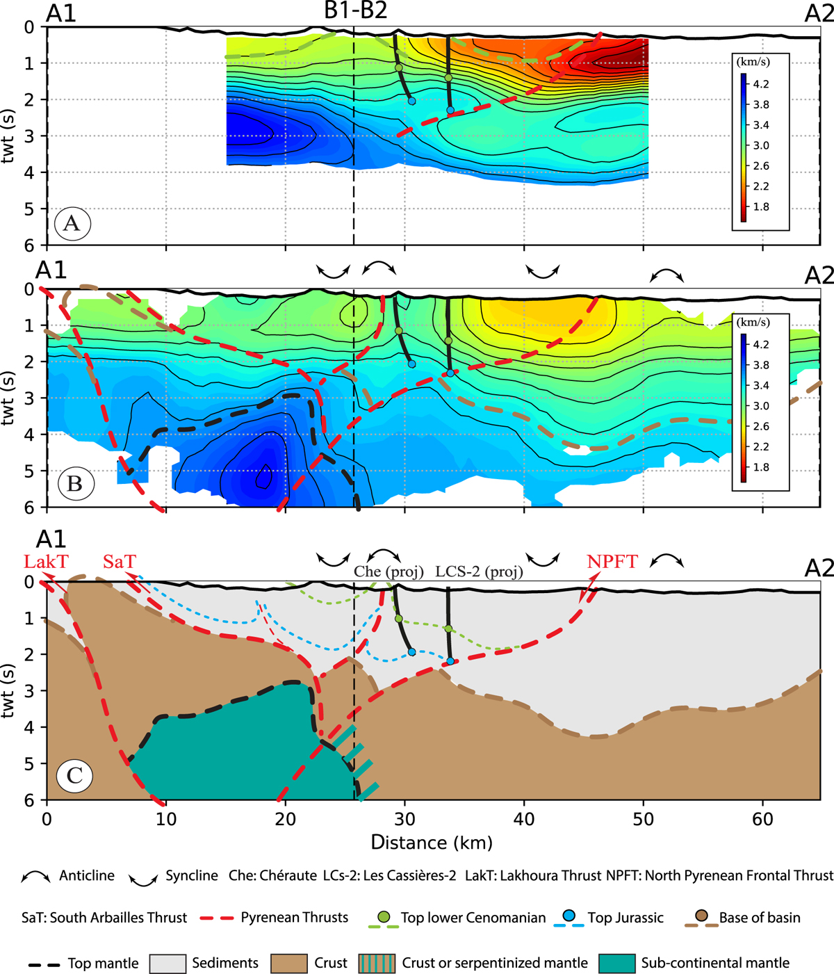
Fig. 14
Download original image
SW-NE profile in the eastern Mauléon Basin showing the interpretation of the SWT (A) and LET (B) models. The final geological interpretation (C) is based on these models, the surface geology and boreholes. Location of axial traces of major anticlines and synclines are based on the geological map. The surface wave model successfully images the first-order basin architecture at shallow depth (syncline/anticline, faults) whereas the local earthquake tomography model provides information about the basement-sediment interface and the geometry of the high velocity body at depth.
Current usage metrics show cumulative count of Article Views (full-text article views including HTML views, PDF and ePub downloads, according to the available data) and Abstracts Views on Vision4Press platform.
Data correspond to usage on the plateform after 2015. The current usage metrics is available 48-96 hours after online publication and is updated daily on week days.
Initial download of the metrics may take a while.