")
")
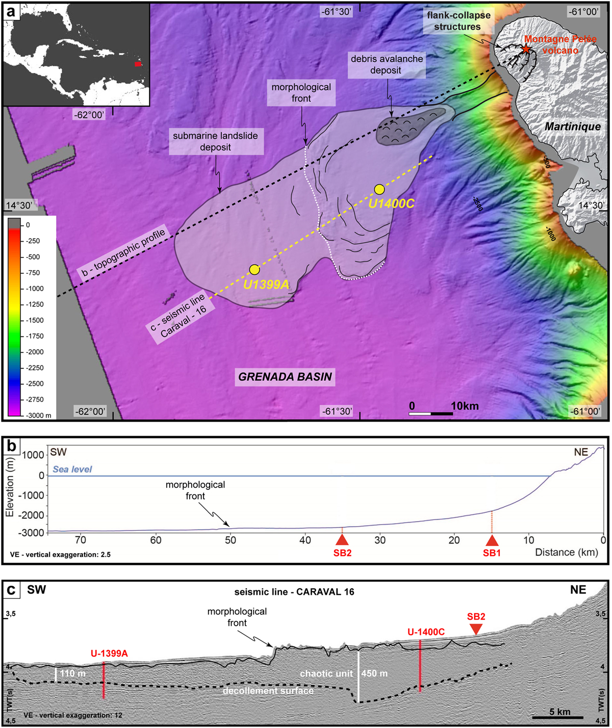
Fig. 1
Download original image
Location, extent of the mass wasting deposits associated with the flank collapses from the Montagne Pelée volcano (Martinique Island) and corresponding profiles. (a) Interpreted bathymetric map of the mass wasting deposit showing the locations of the IODP Expedition 340 drill sites (U-1399A & U-1400C) and topographic profiles (b) and seismic line (c). (b) Topographic profile. SB: slope break. (c) CARAVAL 16 seismic line. Black lines: interpretative limits of the landslide unit deposit (dashed line: basal décollement layer). Terrestrial digital elevation model from the Institut National Géographique et Forestière; Marine geophysical data from the oceanographic cruises AGUADOMAR (1999); CARAVAL (2002) and GWADASEIS (2009) (Deplus et al., 2001, 2002; Feuillet et al., 2010).
Les statistiques affichées correspondent au cumul d'une part des vues des résumés de l'article et d'autre part des vues et téléchargements de l'article plein-texte (PDF, Full-HTML, ePub... selon les formats disponibles) sur la platefome Vision4Press.
Les statistiques sont disponibles avec un délai de 48 à 96 heures et sont mises à jour quotidiennement en semaine.
Le chargement des statistiques peut être long.