")
")
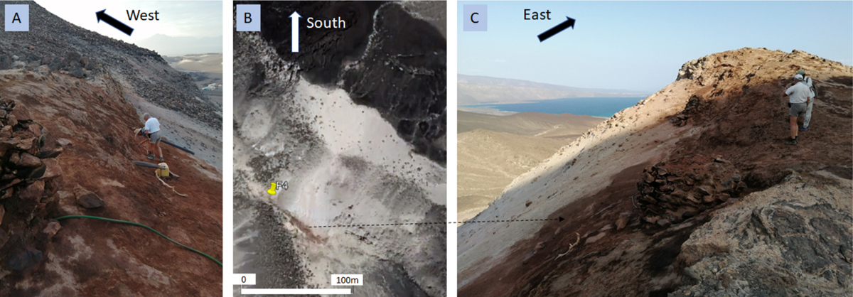
Fig. 3
Download original image
Site 4 of the Asal–Ghoubbet rift. A. View towards the west and Lake Asal, showing plastic tubes installed by local inhabitants to collect fresh water. B. Satellite view, showing the area affected by the fumaroles with visible surface alteration in brown. C. View to Ghoubbet Bay, showing the eastern hydrothermal zone with numerous fumaroles and Afar condensation wells. The scarp of the N140°-oriented north-dipping normal fault clearly demonstrates the tectonic activity of this central part of the rift.
Current usage metrics show cumulative count of Article Views (full-text article views including HTML views, PDF and ePub downloads, according to the available data) and Abstracts Views on Vision4Press platform.
Data correspond to usage on the plateform after 2015. The current usage metrics is available 48-96 hours after online publication and is updated daily on week days.
Initial download of the metrics may take a while.