Fig. 1

Download original image
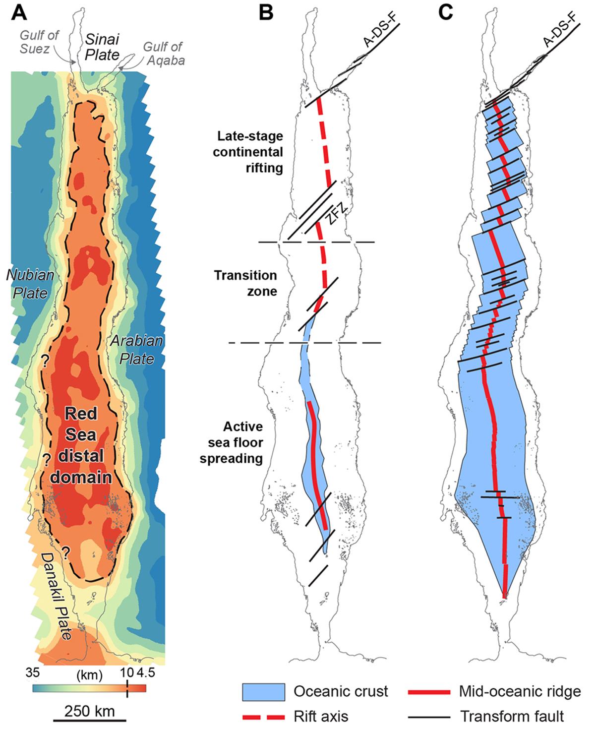
(A) Crustal thickness map constructed by subtracting the basement from the moho depth maps (Supp. Data 1C and 1D). The hatched line is the 10 km iso-thickness marking the transition between the necking and the distal domains. (B) “Mainly rift” tectonic model redrawn from Bosworth (2015). (C) Mainly ocean tectonic model redrawn from Delaunay et al. (2023). A-DS-F: Aqaba-Dead-Sea Fault; ZFZ: Zabargad Fracture Zone. Projection system: Ain el Abd 1970, Aramco, Lambert 2. Rotation: −26.75°.
Les statistiques affichées correspondent au cumul d'une part des vues des résumés de l'article et d'autre part des vues et téléchargements de l'article plein-texte (PDF, Full-HTML, ePub... selon les formats disponibles) sur la platefome Vision4Press.
Les statistiques sont disponibles avec un délai de 48 à 96 heures et sont mises à jour quotidiennement en semaine.
Le chargement des statistiques peut être long.


