")
")
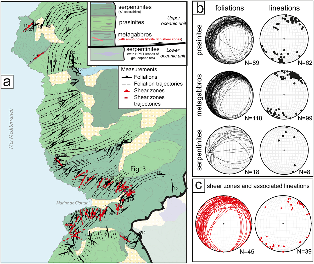
Fig. 2
Download original image
Tectonic map and main amphibole-chlorite shear zones in Marine de Giottani metagabbros (see location on Fig. 1). A. Geological map (from BRGM) with foliation measurements and trajectories (in black) and with observed amphibole-chlorite shear zones (in red). Violet star for the location of key outcrops shown in Fig. 3. B. Stereoplots of foliation and lineation measurements in metabasalts (prasinites), metagabbros and serpentinites (lithologies of the Upper Oceanic Unit (Fig. 1) in Marine de Giottani). C. Stereoplots of amphibole-chlorite shear zones and associated lineations.
Current usage metrics show cumulative count of Article Views (full-text article views including HTML views, PDF and ePub downloads, according to the available data) and Abstracts Views on Vision4Press platform.
Data correspond to usage on the plateform after 2015. The current usage metrics is available 48-96 hours after online publication and is updated daily on week days.
Initial download of the metrics may take a while.