")
")
Fig. 11
Download original image
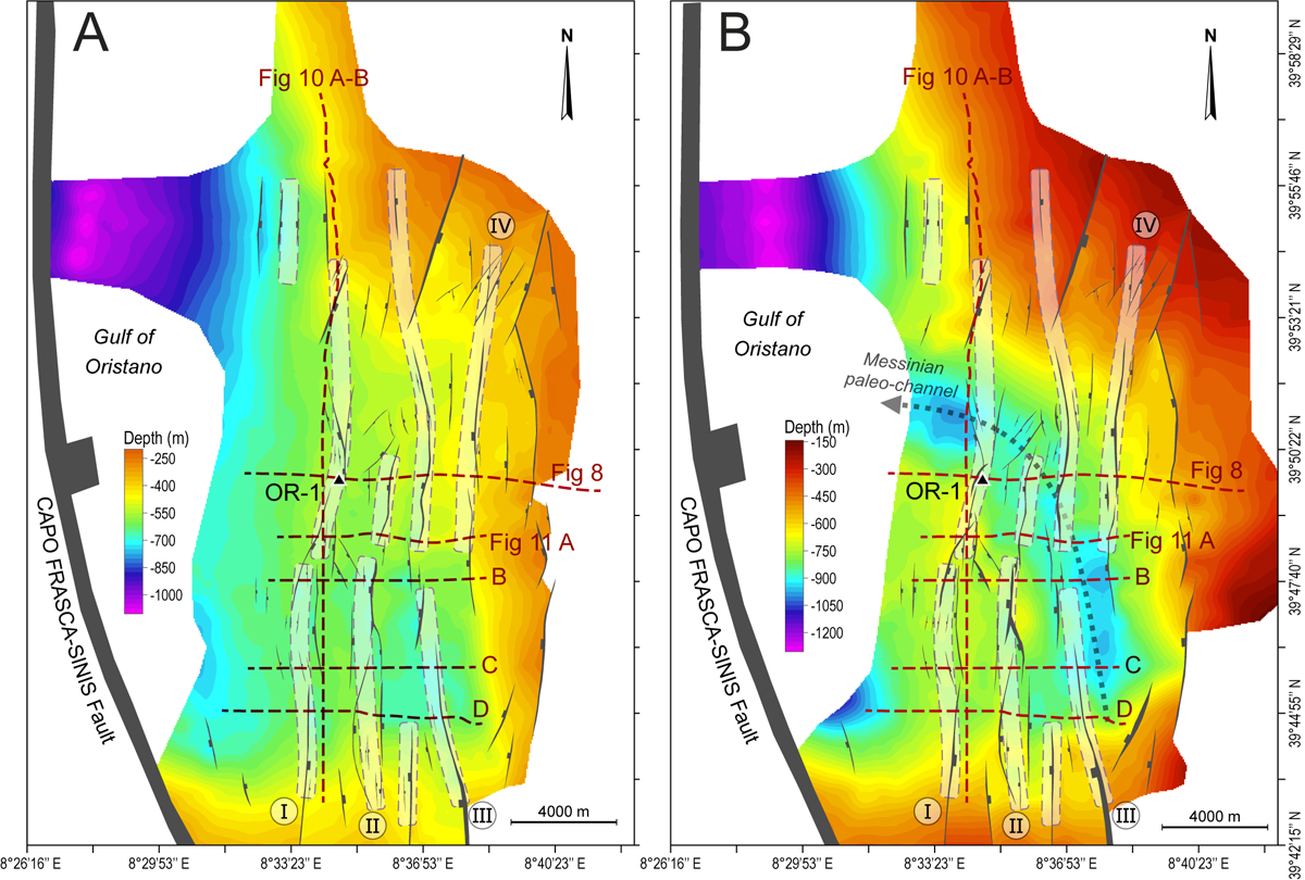
Structural depth maps of the Base continental Pliocene Samassi Fm (Fig. 11A) and of the MES (Fig. 11B). Stratigraphic calibration by OR-1 allowed mapping seismic horizons and the main faults. They show the thickening and deepening of the Plio-Quaternary along the active Capo Frasca −Sinis Fault and the intense Late Miocene to Recent faulting N-S oriented. Four main continuous faults trends (I to IV) are picked and interpreted as strike-slip faults. Figure 11B displays a Messinian paleo-channel whose course was influenced by the Late Miocene tectonic deformations (Cornée et al., 2008).
Current usage metrics show cumulative count of Article Views (full-text article views including HTML views, PDF and ePub downloads, according to the available data) and Abstracts Views on Vision4Press platform.
Data correspond to usage on the plateform after 2015. The current usage metrics is available 48-96 hours after online publication and is updated daily on week days.
Initial download of the metrics may take a while.