")
")
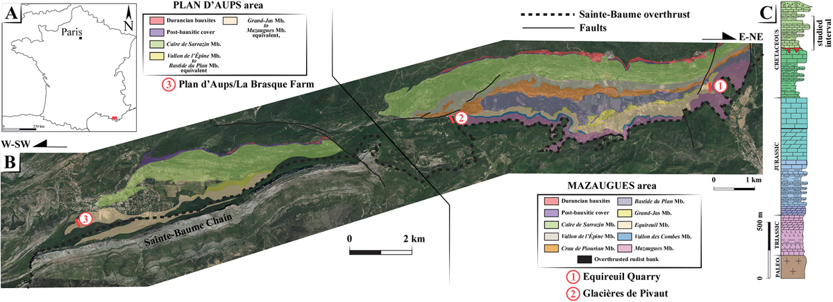
Fig. 1
Download original image
A: situation map of the Saint Baume Massif in southern France; B: Google Earth satellite view and sketchy geological map of the Plan d’Aups, and Mazaugues study areas, including the three amber-bearing sites (Pt. 1: Equireuil quarry, Pt. 2: Glacières de Pivaut, and Pt. 3: Plan d’Aups-La Brasque Farm) and C: schematic sedimentary succession of the Sainte-Baume Massif (modified from Bestani et al., 2015).
Current usage metrics show cumulative count of Article Views (full-text article views including HTML views, PDF and ePub downloads, according to the available data) and Abstracts Views on Vision4Press platform.
Data correspond to usage on the plateform after 2015. The current usage metrics is available 48-96 hours after online publication and is updated daily on week days.
Initial download of the metrics may take a while.