")
")
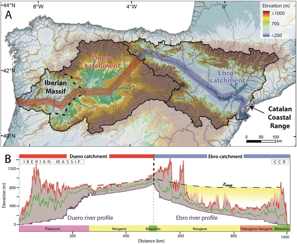
Fig. 1
Download original image
(A) Current topography of the Ebro and Duero basins in the northern part of Iberia. Black dashed line represents the current position of the bedrock incision knickpoint wave in the Duero Basin (Struth et al., 2019). (B) Swath profile of both basins indicating the maximum (red line), mean (green line) and minimum elevation (blue line; river profile). Zmax indicates the maximum infill elevation. CCR: Catalan Coastal Range. The x-axis indicates the age of the bedrock and sediment outcropping along the profile.
Current usage metrics show cumulative count of Article Views (full-text article views including HTML views, PDF and ePub downloads, according to the available data) and Abstracts Views on Vision4Press platform.
Data correspond to usage on the plateform after 2015. The current usage metrics is available 48-96 hours after online publication and is updated daily on week days.
Initial download of the metrics may take a while.