Fig. 1

Download original image
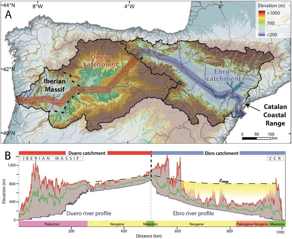
(A) Current topography of the Ebro and Duero basins in the northern part of Iberia. Black dashed line represents the current position of the bedrock incision knickpoint wave in the Duero Basin (Struth et al., 2019). (B) Swath profile of both basins indicating the maximum (red line), mean (green line) and minimum elevation (blue line; river profile). Zmax indicates the maximum infill elevation. CCR: Catalan Coastal Range. The x-axis indicates the age of the bedrock and sediment outcropping along the profile.
Les statistiques affichées correspondent au cumul d'une part des vues des résumés de l'article et d'autre part des vues et téléchargements de l'article plein-texte (PDF, Full-HTML, ePub... selon les formats disponibles) sur la platefome Vision4Press.
Les statistiques sont disponibles avec un délai de 48 à 96 heures et sont mises à jour quotidiennement en semaine.
Le chargement des statistiques peut être long.


